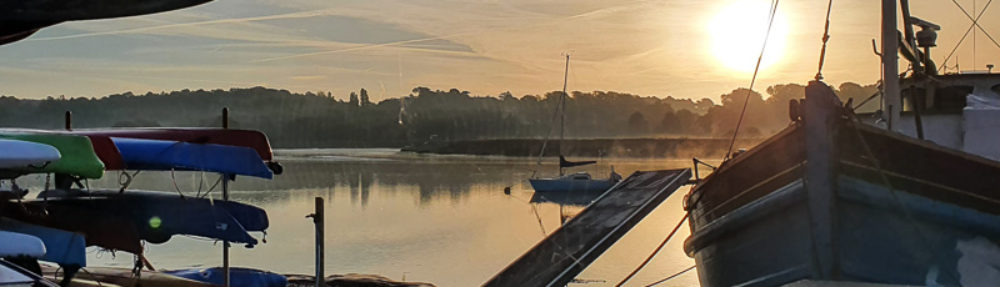
Estuary saltmarshes are an ecologically unique tidal area of marshland which is regularly flooded with salt or brackish water and then drained by the lowering tide. The River Deben has the highest amount of saltmarsh of any Suffolk River. It extends 18km from Felixstowe Ferry up to Melton. The width of saltmarsh between the river channel and bank varies from nothing to over 600m between Hemley and Waldringfield. Salt-tolerant plants stabilise incoming sediment creating a marsh environment that supports the aquatic food chain, provides essential coastal flood protection and improves carbon storage.
The Deben saltmarsh started life when the sea entered the river near Felixstowe Ferry some 6500 years ago converting the fringing freshwater marsh into mature saltmarsh. During the time since then the level of the saltmarsh has risen 14m from the deposition of sea borne sediments. This has kept in line with rising sea levels and Mean High Water Springs. The area of saltmarsh has also grown and has reached 18km upstream and 3km to the sides of the estuary, the lower reaches of the river have widened from about 8m to 550m through wind fetch and surge flow erosion – the latter from increasing surge volumes that flooded the growing area of open (unembanked) saltmarsh.
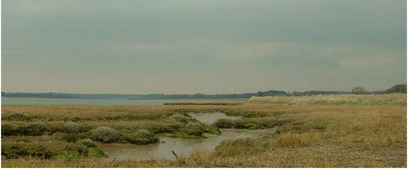
Between the 16th and 17th centuries large areas of saltmarsh were embanked to create arable land and grazing marsh. This resulted in a significant drop in surge flow erosion and caused an increase in mudflat and saltmarsh growth. However, in common with many Suffolk and Essex estuaries a new and serious problem has arisen – the loss of saltmarsh within the area away from the river edge (see above photo). The cause of this needs to be identified. This area is not affected by wind fetch or sea level rise and a possible cause is shore crab burrowing. This is currently under investigation by the RDA Saltmarsh Research Group which was set up in September 2016 to try and determine why and how saltmarshes on the river Deben erode and regenerate.
Details of its meetings can be found <here>.
In 2014 Robert Simper catalogued <the changes> that had taken place over the past fifty years.
Section through Saltmarsh and River Edge
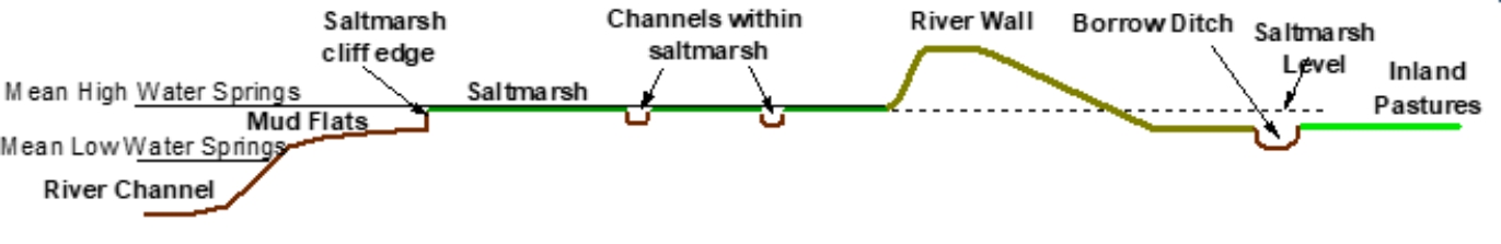
The section through a typical area of saltmarsh shows that the level of external saltmarsh has risen over 1m in line with sea level rise since the grazing marsh was embanked 300 to 400 years ago.
In recent years the value of saltmarshes has been recognised and promoted by the Government. Local groups are being encouraged to find ways to help conserve saltmarsh (find ways to slow or reverse the current erosion), including restoration with the beneficial use of dredgings.
The value of saltmarshes includes:
- providing essential protection to the <river walls>.
- providing a high biodiversity supporting a wide range of flora and fauna, <ecosystems and marine habitats>.
- providing carbon storage.
A note ‘<Saltmarsh Restoration>’, written in October 2017, considers the current state of the saltmarshes on the River Deben and gives some possible reasons for their deterioration together with other observations. Proposals are made for a possible trial to help restore badly eroded areas. Since the note was written more emphasis is being given to the use of <dredgings> for saltmarsh restoration.
In 2021 a report ‘<Saltmarsh research on the River Deben>’ describes the research work carried out at Waldringfield and Loder’s Cut Island between 2014 and 2020.
Saltmarsh Restoration Report – Sep 17
- Saltmarsh Restoration Report Sep 17
- Appendix A to SR Report – Dredging
- Appendix B of SR Report – Changes