by Colin Nicholson
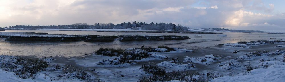
The tidal Deben Estuary is under assault, with Bawdsey Haven Yacht Club at the mouth of the estuary and Waldringfield Sailing Club half-way-up the estuary taking up the challenge to hold the line and retain public footpaths. And at the topmost end of the tidal Deben, just south of Ufford Pools, the bank of the main river is threatening to collapse, putting that public footpath under threat.
The causes are complex with no single factor to blame and this journal article attempts to capture and promote the current position. Further updates will be required as the situations evolve. Taking each location in turn…
SOUTH OF BAWDSEY QUAY
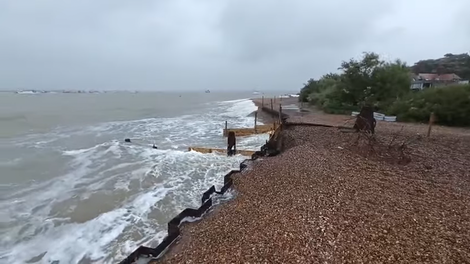
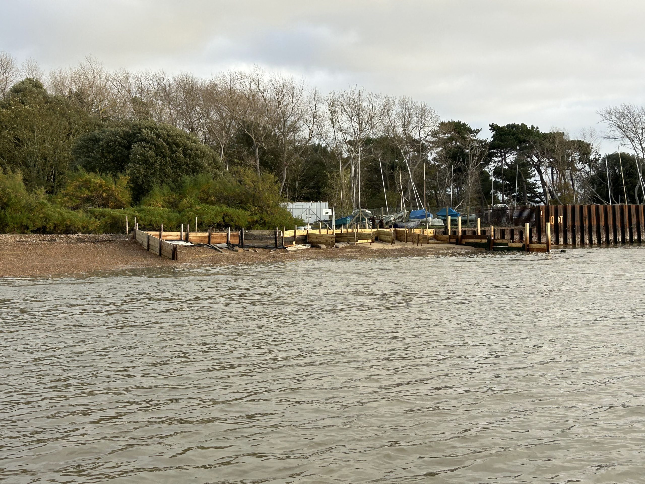
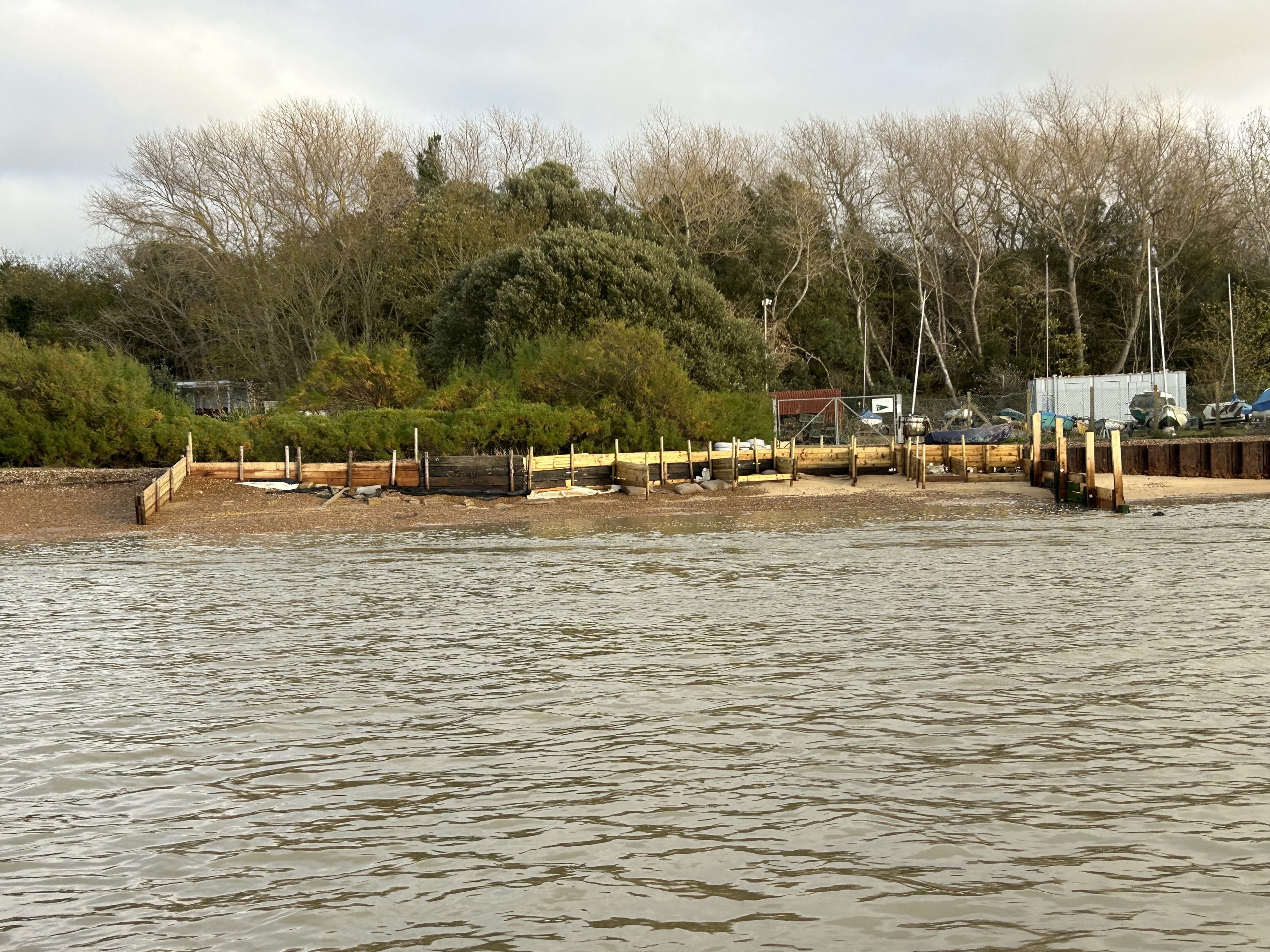
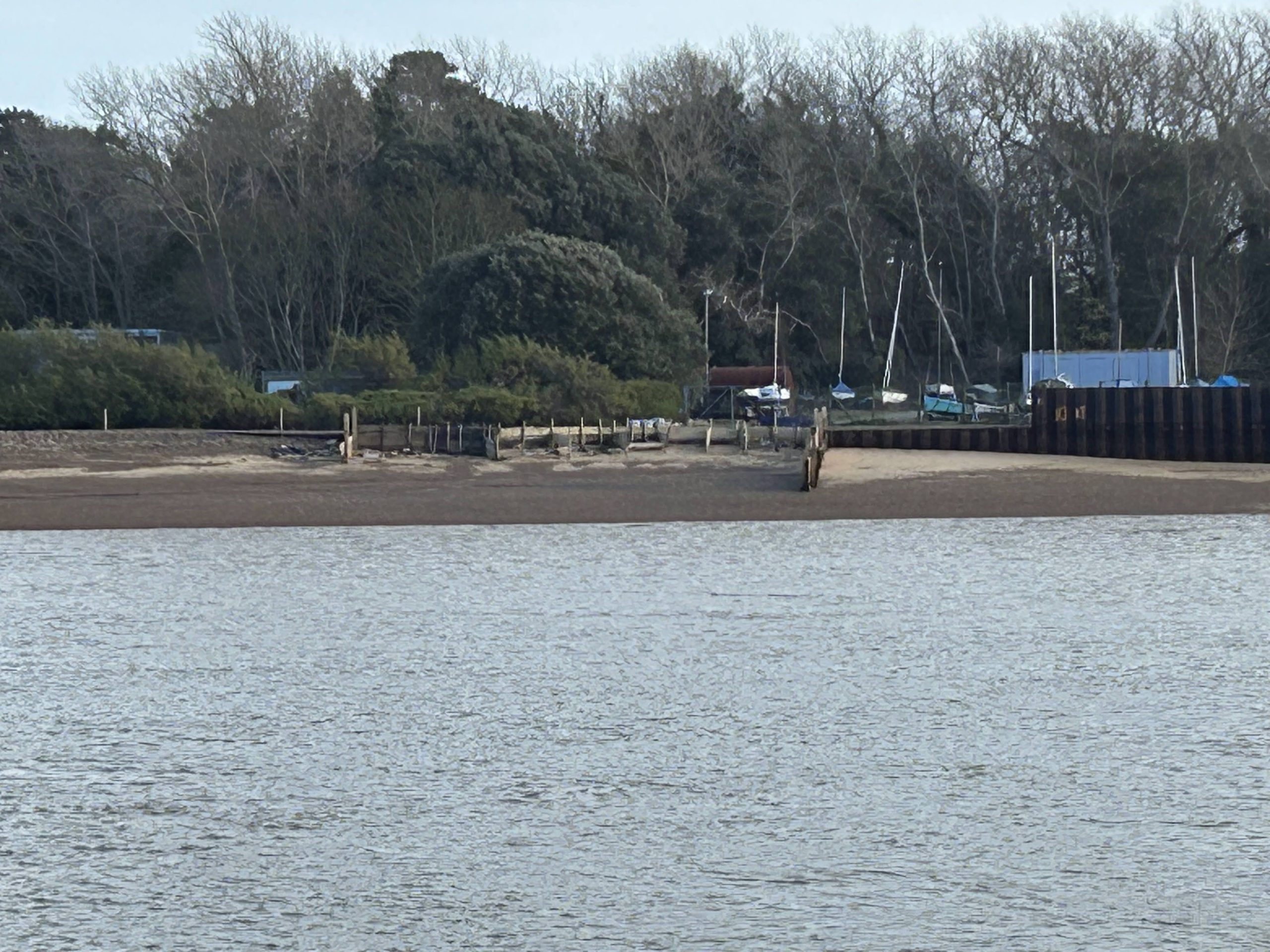
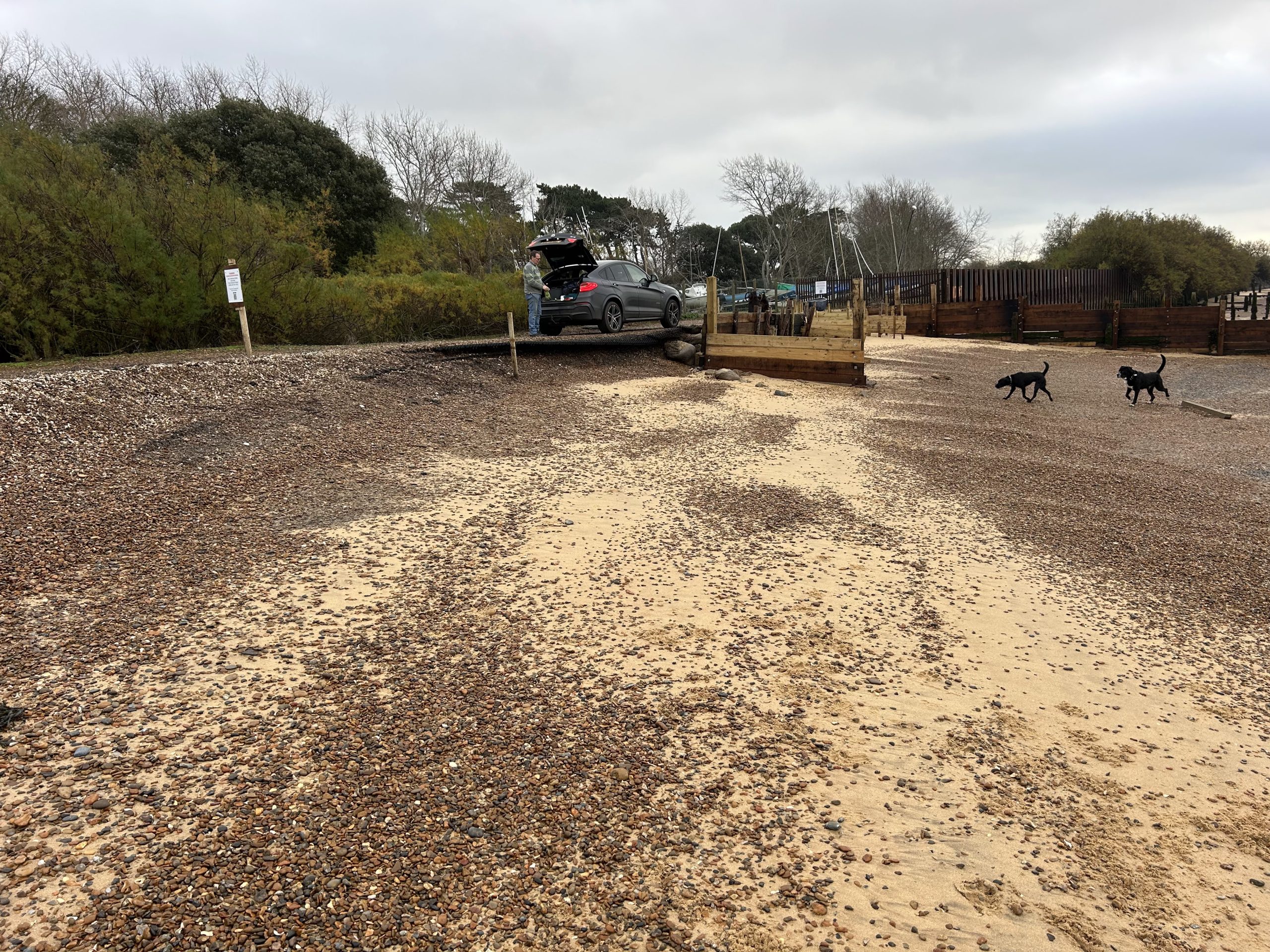
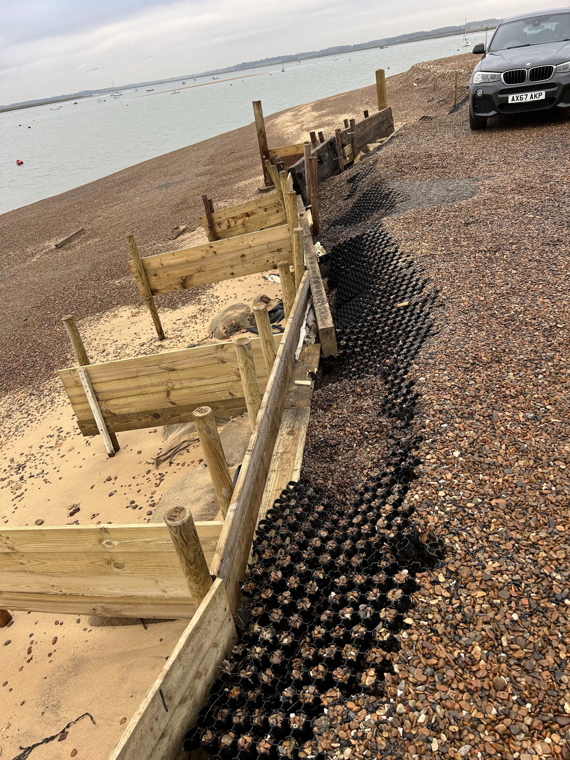
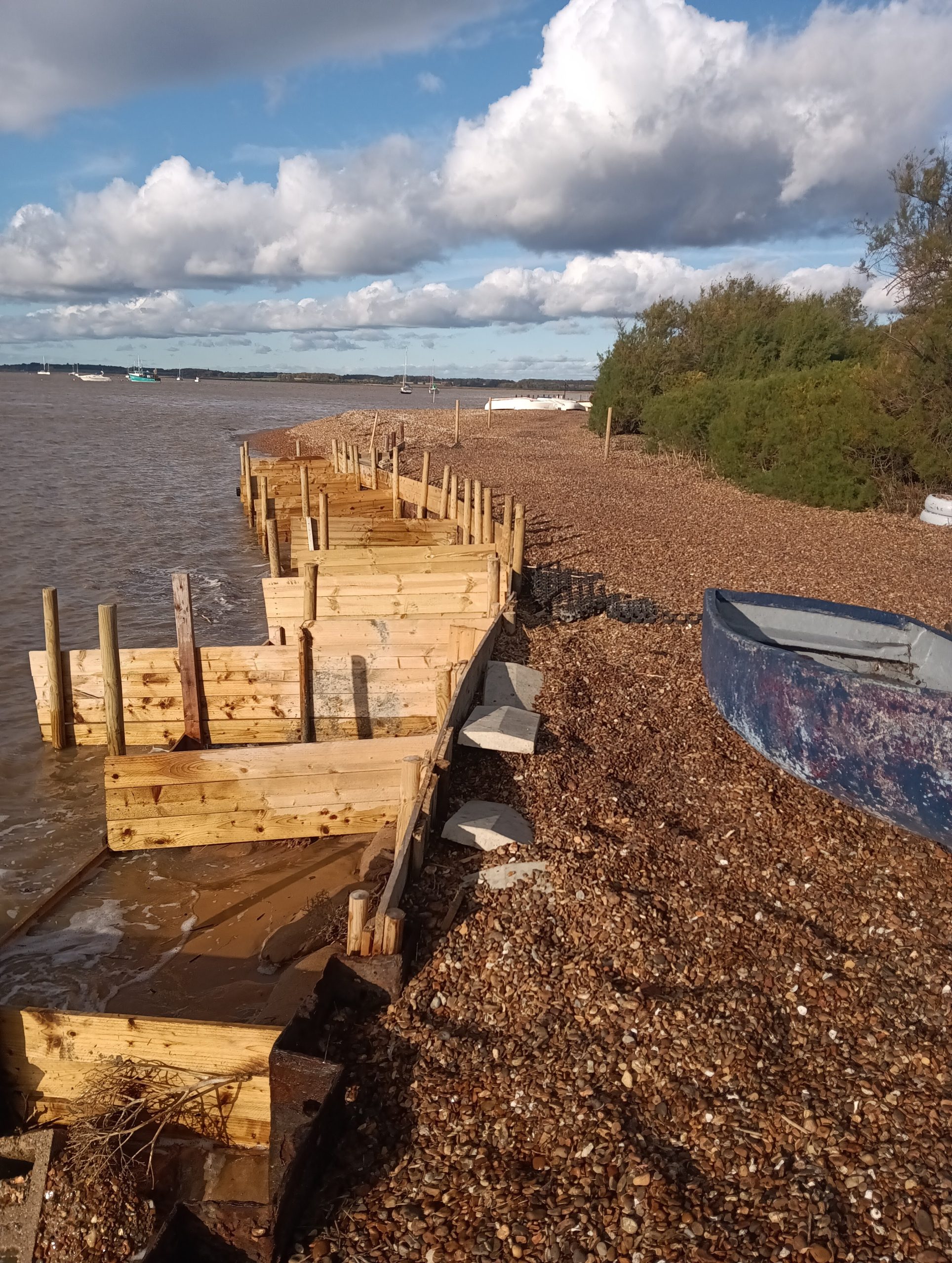
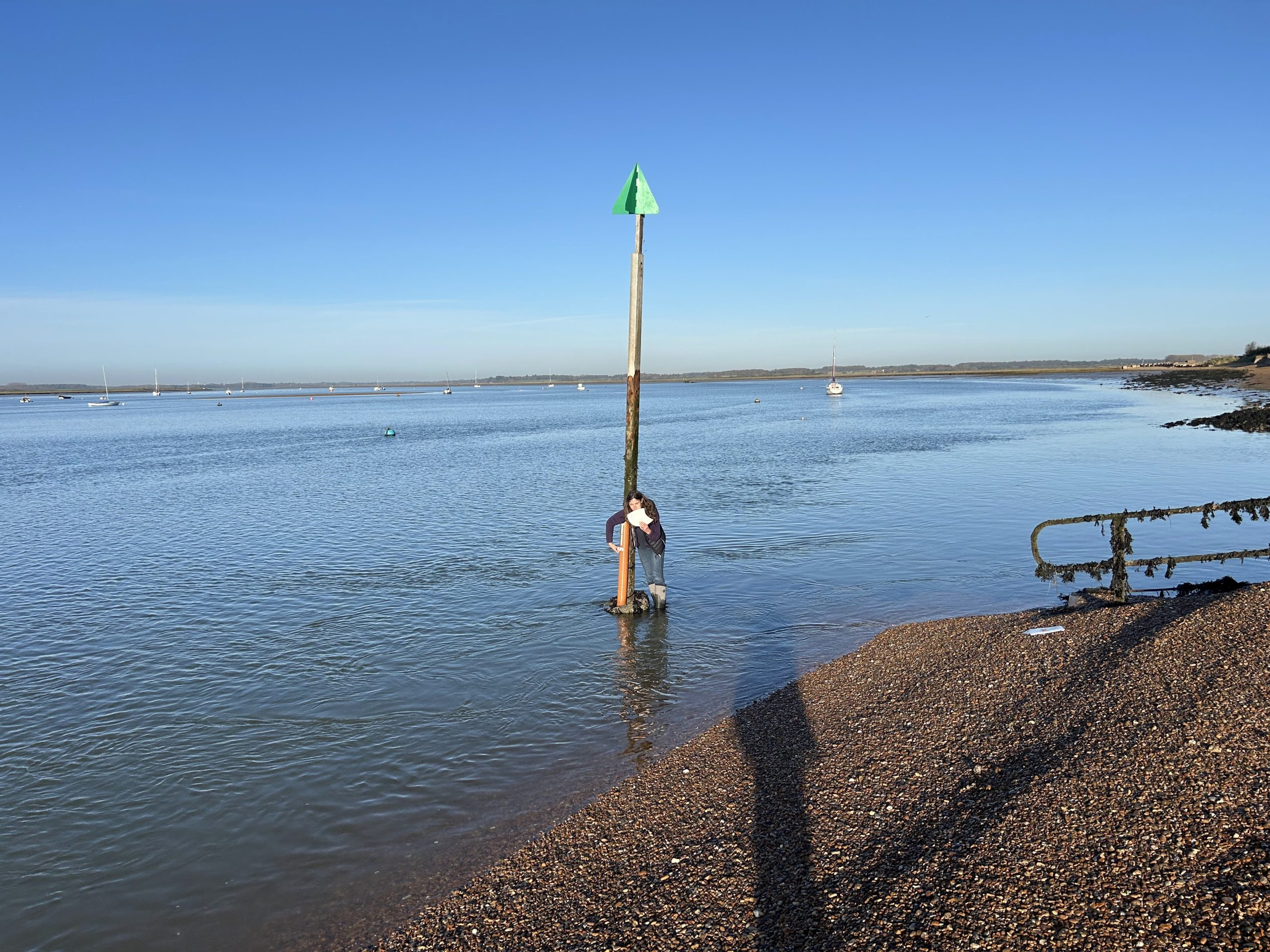
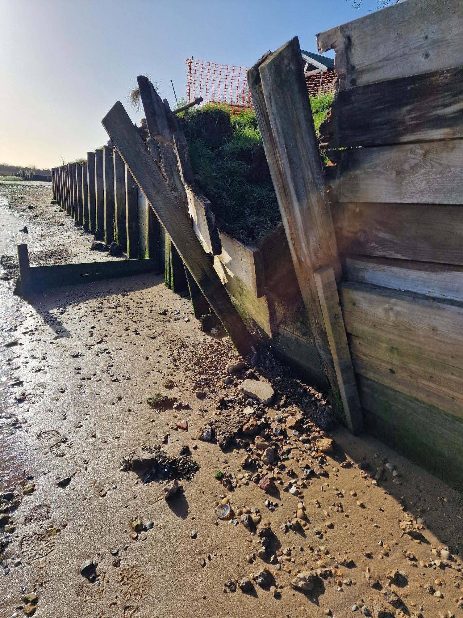
Since last August, Bawdsey Haven Yacht Club has been fighting severe shingle erosion to the riverside footpath leading from Bawdsey Quay to Bawdsey Beach. The track not only provides access to the BHYC dinghy park, but also to the beach beyond at Bawdsey Point. This is visited by over 500 hundred people on a sunny day during the summer and is also used year-round by fishermen, walkers and dog owners.
Professor Burningham’s Bawdsey Report
Professor Helene Burningham discussing erosion at East Lane
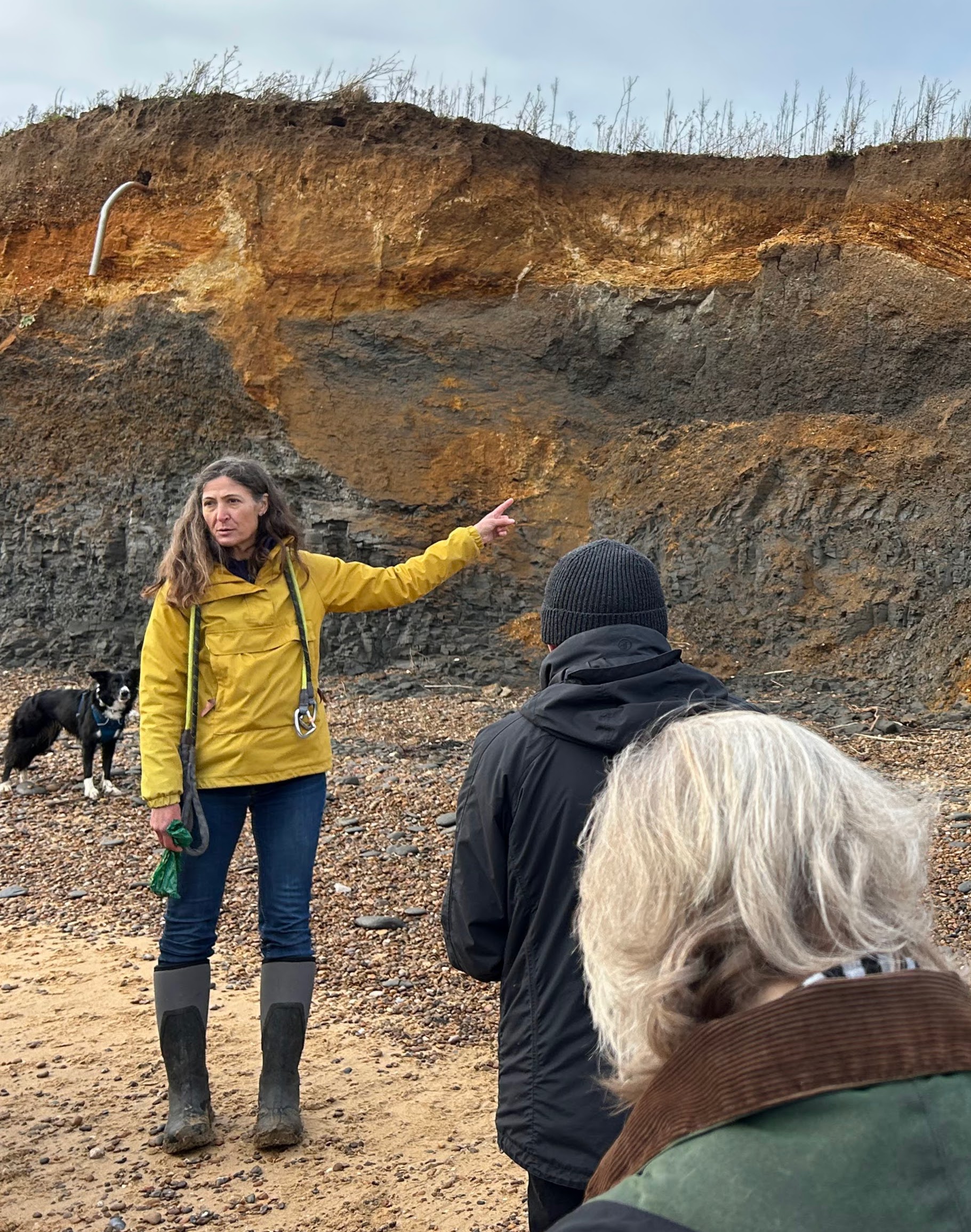
The RDA Journal affords space to go into more detail where available and Professor Helene Burningham (a coastal scientist and Professor of Physical Geography in University College London’s Department of Geography who has been studying coastal geomorphology and sediment movement at the mouth of the River Deben for over 10 years,) has written a brief report, with photographs, on the local situation, (please follow link below).
> Prof Burningham’s full report – ‘Bawdsey Foreland Comparison’ (NB This is a large file 55MB so may take time to download)
Prof Burningham’s report is based on a mix of drone images, aerial photography and the beach level data collected by the Bawdsey Beach Monitoring Group. (Link to group’s website)
The Bawdsey Beach Monitoring Group are a voluntary citizen science initiative based on the Bawdsey peninsula and they have been measuring beach levels at Bawdsey Beach (in the region of the iron sheet piling) since 2013. Their measuring is usually undertaken on a weekly basis, and at 17 different survey points along the Bawdsey Beach frontage. In 2016, the monitoring was extended to include 11 sites along the Deben inlet margin in the direction of Bawdsey Quay.
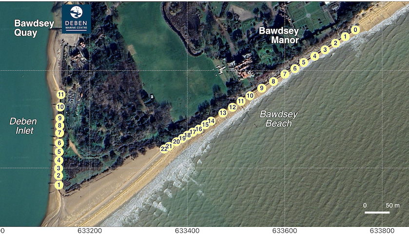
To date, the group have collected almost 10,000 records of beach level, and these measurements capture both the short-term responses in the beach to changing weather conditions, and the longer-term changes associated with the wider sediment dynamics of this coast, and in particular The Knolls at the inlet. To have this level of detail is quite incredible, but it is also amazing how complicated the dynamics are in this area and that there are many factors that influence whether erosion or accretion are dominant.
In Prof Burningham’s view, the spit (or Bawdsey Point) is really suffering with a general lack of sediment (sand/shingle) supply (albeit the sand eroded from Bawdsey cliffs is at least contributing somewhat). Without intervention, both shorelines (sea and inlet margin) are likely to continue eroding as there isn’t sediment available to supply them. It’s possible that the spit, once there has been a decent period of southerly waves, might bend/recurve into the inlet and provide some sediment supply at measuring point 1 (the seaward end of the iron piling), but it will take some months for this to work along to the quay.

In the meantime, the sediment that has been removed (by tides, weather, wave action) from the BHYC beach is now piling up on the jetty/quay where it will curtail ferry operations. At the very least, given this sediment will need to be removed if the jetty is to be used, there is an opportunity, with a gang of willing volunteers and/or some heavy-duty machinery, to dig out this sediment at the jetty and redistribute it along the BHYC shoreline – best to be placed in the two stretches where losses are most profound – near measuring points 1 and 11 (at either end of the existing sheet piling). The sediment will continue to move back northward (toward the quay), and this might need repeating, but it will do no harm, and potentially bridge the gap until sediment from the spit can make its way along.
But the stark reality is also that the lack of new shingle supply from the north, which effectively stopped around 20 years ago, is now bringing a significant challenge to Bawdsey spit that will not solve itself. A massive injection of sediment is needed.
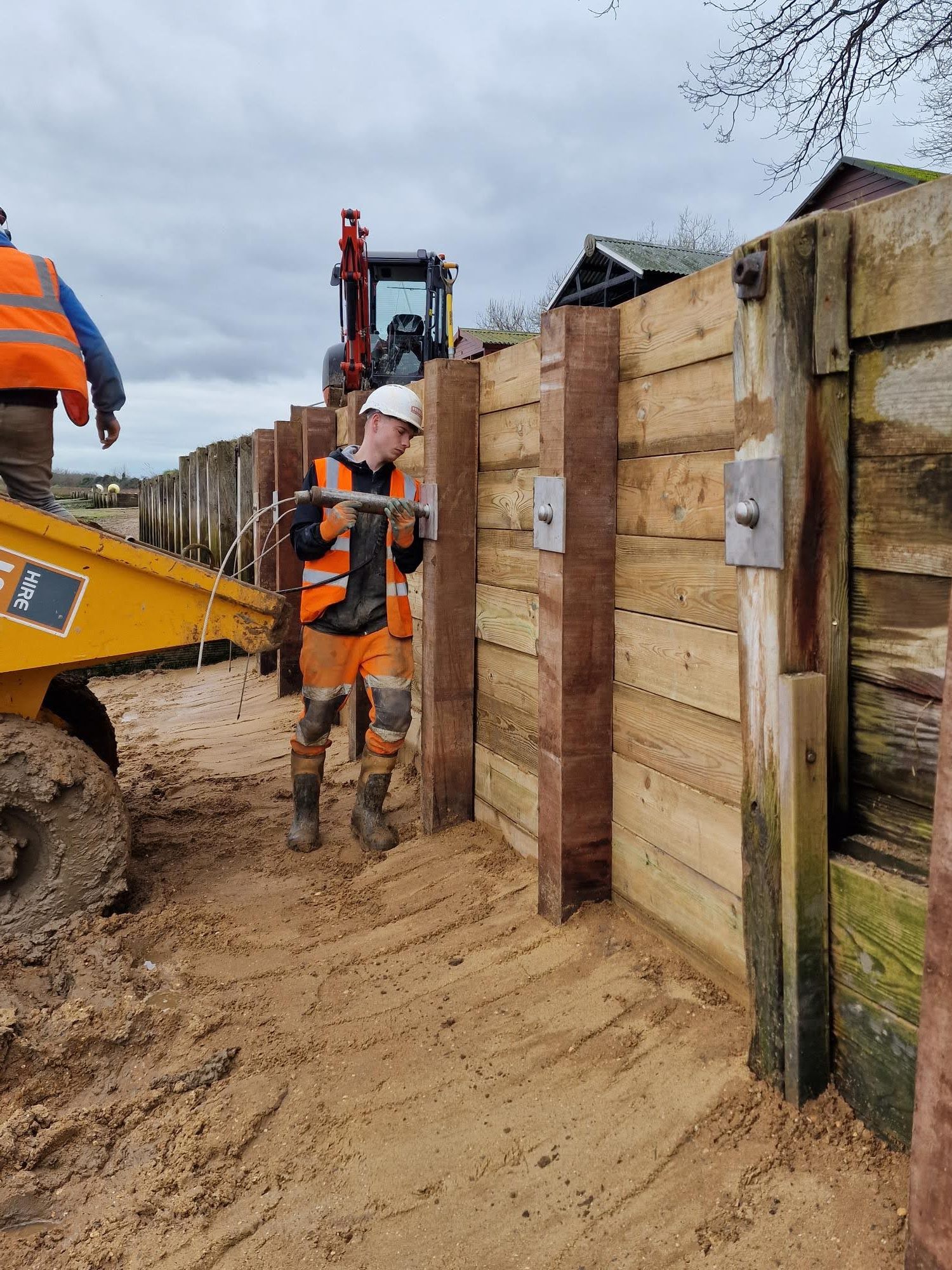
Volunteering effort by Bawdsey Haven Yacht Club

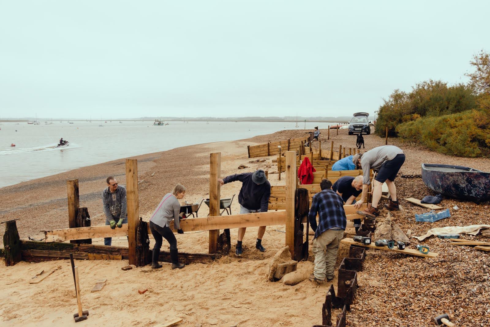
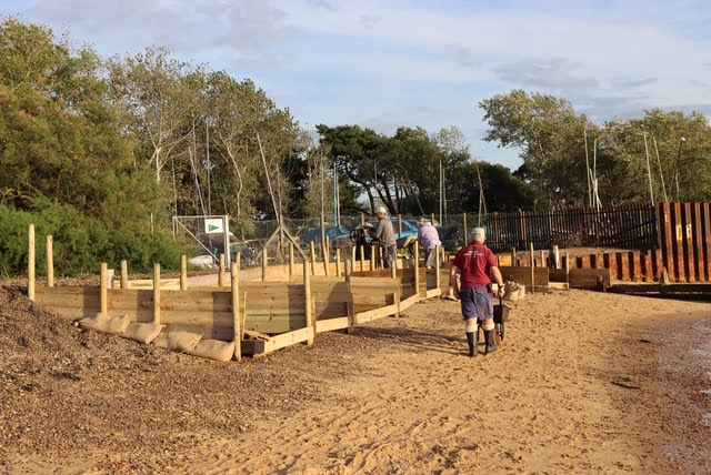
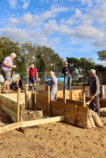
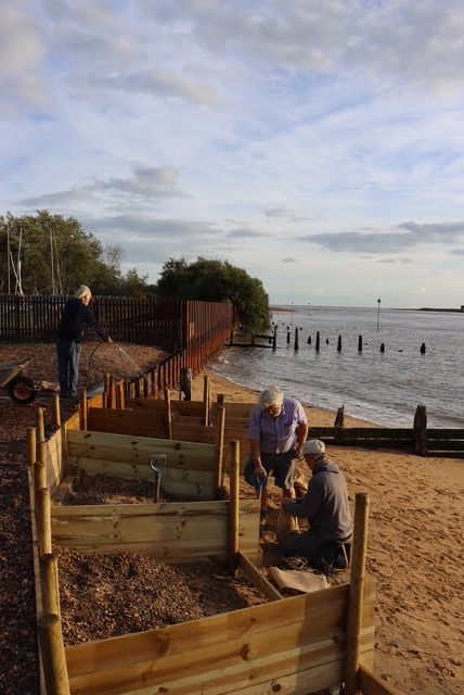
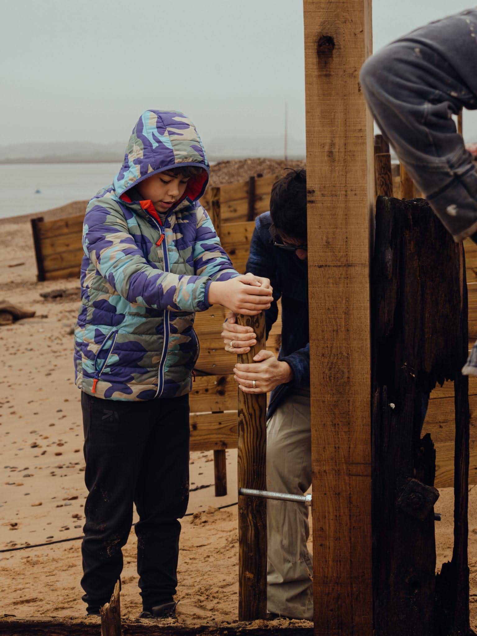
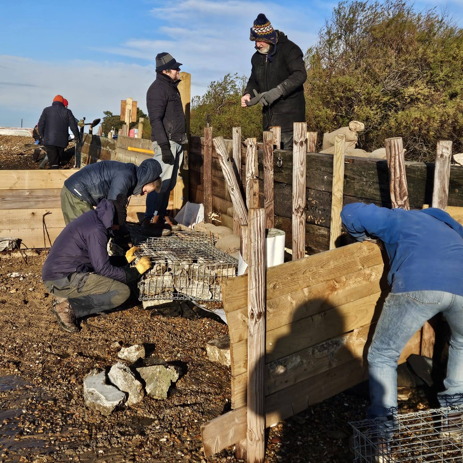
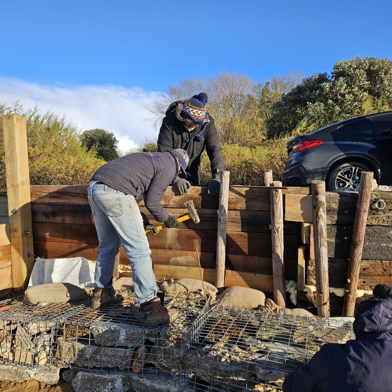
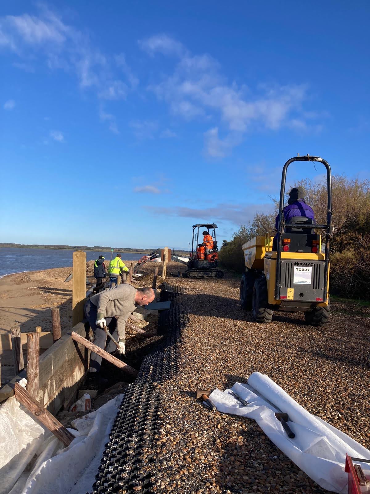
BHYC members have made urgent temporary repairs to the river bank and groynes in front of the entrance to the dinghy park, but more needs to be done. BHYC working parties braved strong winds, freezing conditions and snow flurries to repair and extend the wooden defences and assemble, fill and lay the first of the gabions. Closure of the public footpath would mean the only other access to the beach in front of Bawdsey Manor would be along the river bed. This would bring dangerous public safety issues on a rising tide and the council would therefore have to close the beach to the public. BHYC has spent approximately £7000 of its own funds on the repairs so far, while volunteers have racked up around 500 hours of work.
A gofundme page has been set up and at time of writing has raised £9,139. Thanks to all who have contributed. BHYC is also applying for funding to various local authorities and relevant bodies.
If anyone would like to make a donation, please visit GoFundMe at https://www.gofundme.com/f/save-access-to-bawdsey-sea-front

Since the early autumn, numerous club members have been helping out, forming work parties to build and repair sea defences, contacting local authorities and other bodies to raise awareness, and raising funds to pay for materials already used and for work that will be needed in the near future.
Work done so far:
- Built a wooden retaining wall about 30 metres long with mini “groynes” sticking out from it at 90 degrees.
- Repaired the 15 metre long groyne directly in front of the dinghy park entrance using robust green oak supplied from France.
- Assembled first gabions, filled them with builder’s rubble, stone and marble, and laid them in front of the retaining wall as extra defence/ reinforcement.
Proposed future works and estimated costings
- Repair 15 metre long groyne down stream from boat yard.
Felixstowe boat yard labour and material: £5,000
- Build new groyne 15 metre long in between boat yard and quay.
Material and labour: £6,000
- Replace temporary river wall by permanent wall, minimum length 30 metres. Build replacement boat slipway.
Either using H section posts infilled with hard wood sleepers.
Material and labour. £15,000
Or: using hard wood 2.6 metre sleepers for posts (which would need to be tied back) and similar hardwood planks for the wall.
Material and labour: £12,000.
Applications for funding have been made to an array of likely possibilities: National Lottery; Bawdsey Parish Council; Sizewell C; James Mallinder (local councillor for Suffolk Coastal Council); Anglia Water; Felixstowe Dock; Scottish Power; Suffolk County Council, Crown Estates; East Suffolk Council.
The urgent requirement was to stabilise the river bank and prevent the track leading to the dinghy park and the public footpath from being washed away. There have been a few failures during some of the storms and surge tides over the last few months, but BHYC have begun to learn what works and what doesn’t and have now almost managed to stabilise the situation, at least for the moment. It is appreciated that the river wall defences are not permanent and will need to be replaced with a long-term solution.
Slideshow – images (click right and left arrows to view)


Slideshow – videos (click video to run )
.
WALDRINGFIELD

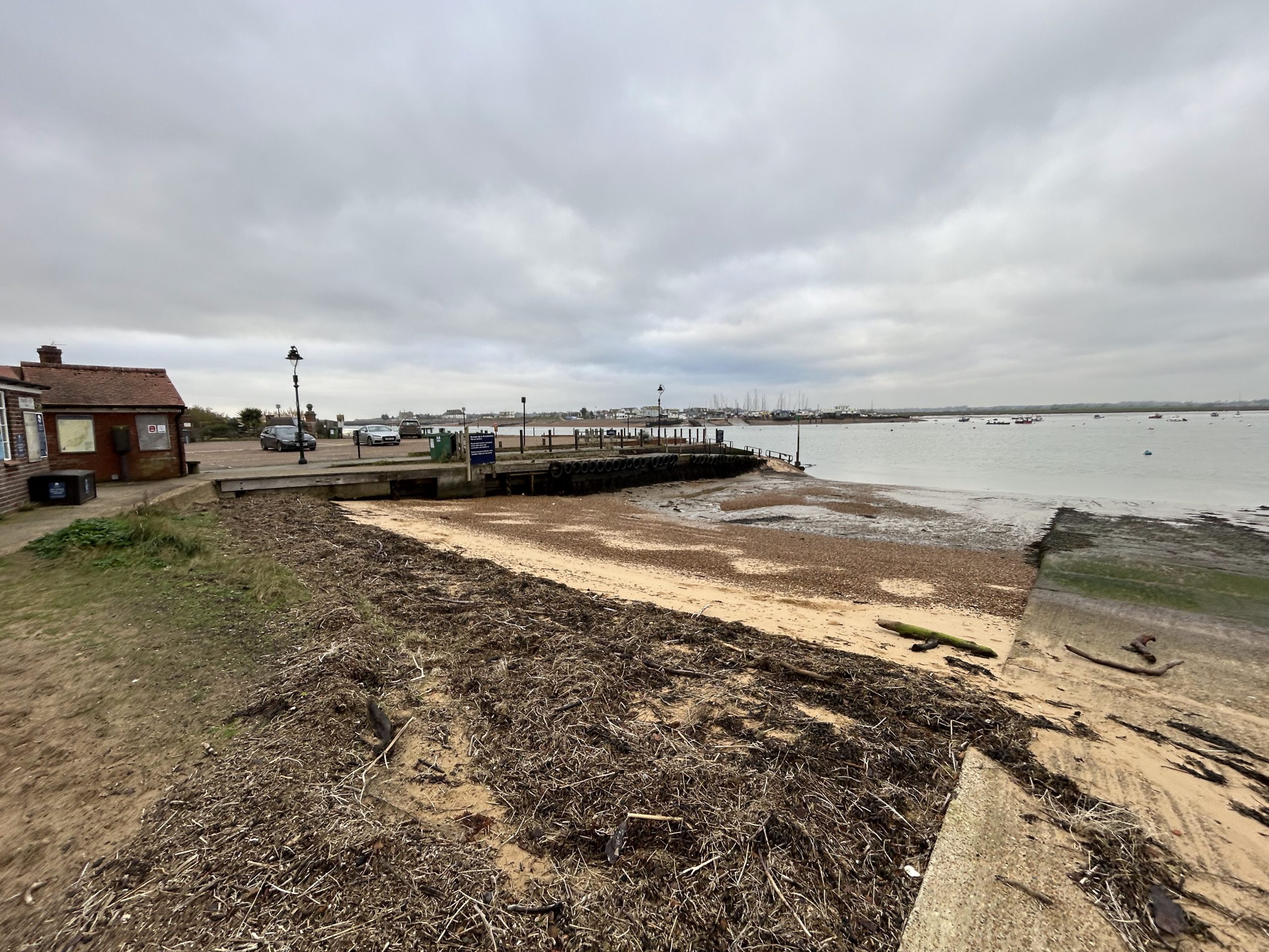
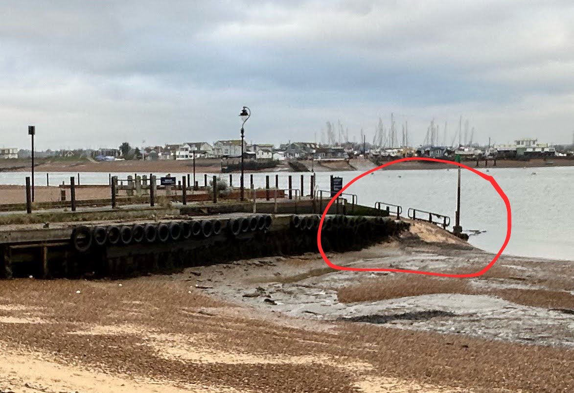
Waldringfield is used to seeing its beach change with the seasons and from the effects of weather and tides, but in more recent times there has been a noticeable increase in mud and a corresponding reduction in sand, most noticeably up near the quay and in front of the sailing club and forward-most huts.
Most recently there has been a marked drop in the level of the beach below the raised footpath that runs in front of the club, with much of the sand that used to be there shifting to further up-river below the cliff. This has almost certainly been caused by a combination of more severe weather events and the consequent scouring effect of wave action and increased tidal flows.
This has seen the level of the beach here drop by at least 6-8 inches and so further expose the base of the revetment wall that supports the raised footpath. This has started to undermine the revetment wall which, due to its age, is now quite worn in places and almost certainly also being stressed by the impact of rainwater run-off from the field and cliff behind.
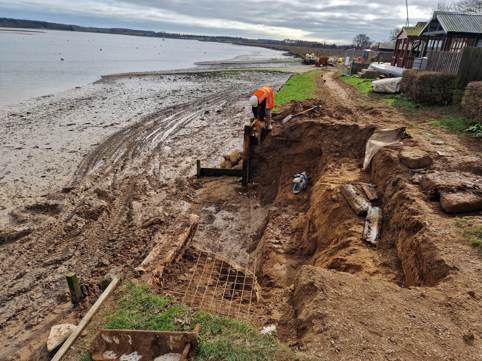
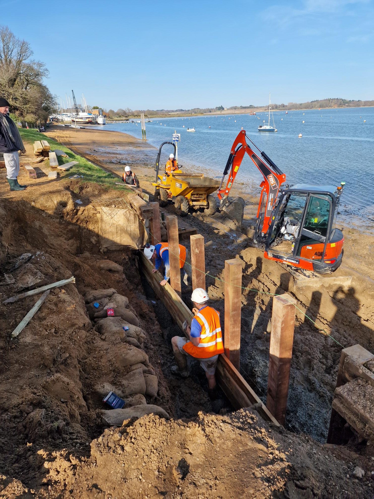
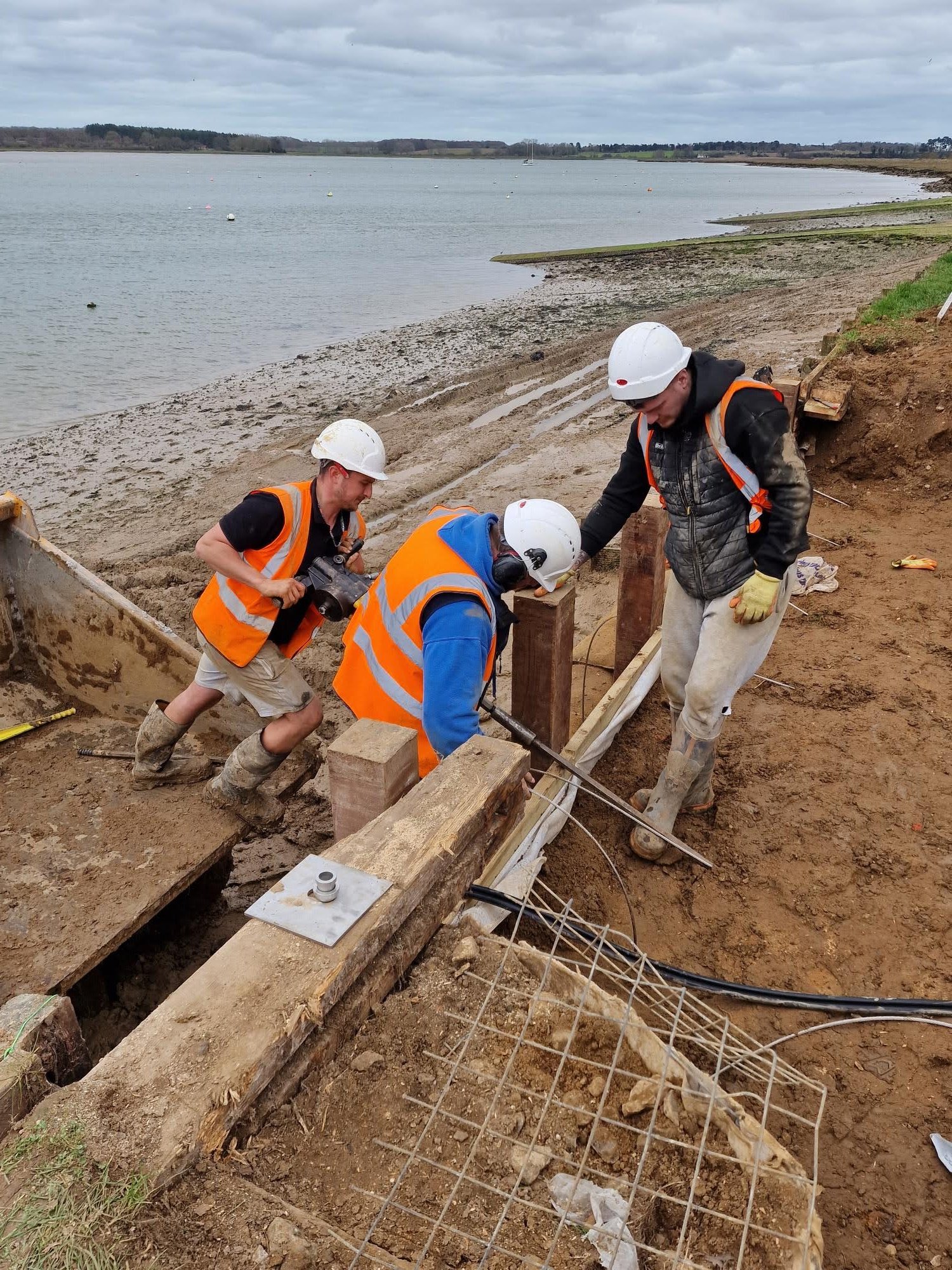
Towards the end of 2025, all of these factors came together to cause a small section of the wall to start failing. As a consequence, Waldringfield Sailing Club, as the riparian owner, arranged to have this section repaired in the last week of February by a construction company from Bury called Hazleton Construction, who they have used before for similar work.

The old damaged timbers were removed and replaced them with Iroko hardwood posts and treated softwood planking, backed with permeable geotextile fabric, all supported by platypus anchors driven deep into the bank behind it. A considerable amount to soil had to be removed from the bank to enable this work to be done and it was then returned and compacted in stages as the planking and anchors were installed. This has returned the footpath to its previous safe and useable condition.
This unplanned work has come at a considerable cost for the Sailing Club, who are extremely grateful for any financial contributions to help defray its impact on their reserves. It has also been a wake-up call for all stakeholders about the vulnerability of large parts of this very popular beach to the effects of increased tidal flow and the extreme weather and will no doubt generate much discussion about how to protect and maintain it in future years.
In an appeal for funding, those interested in contributing to the extensive costs of the repairs are encouraged to contact John Ogden at [email protected]
Slideshow – images (click right and left arrows to view)
.
LOWER UFFORD
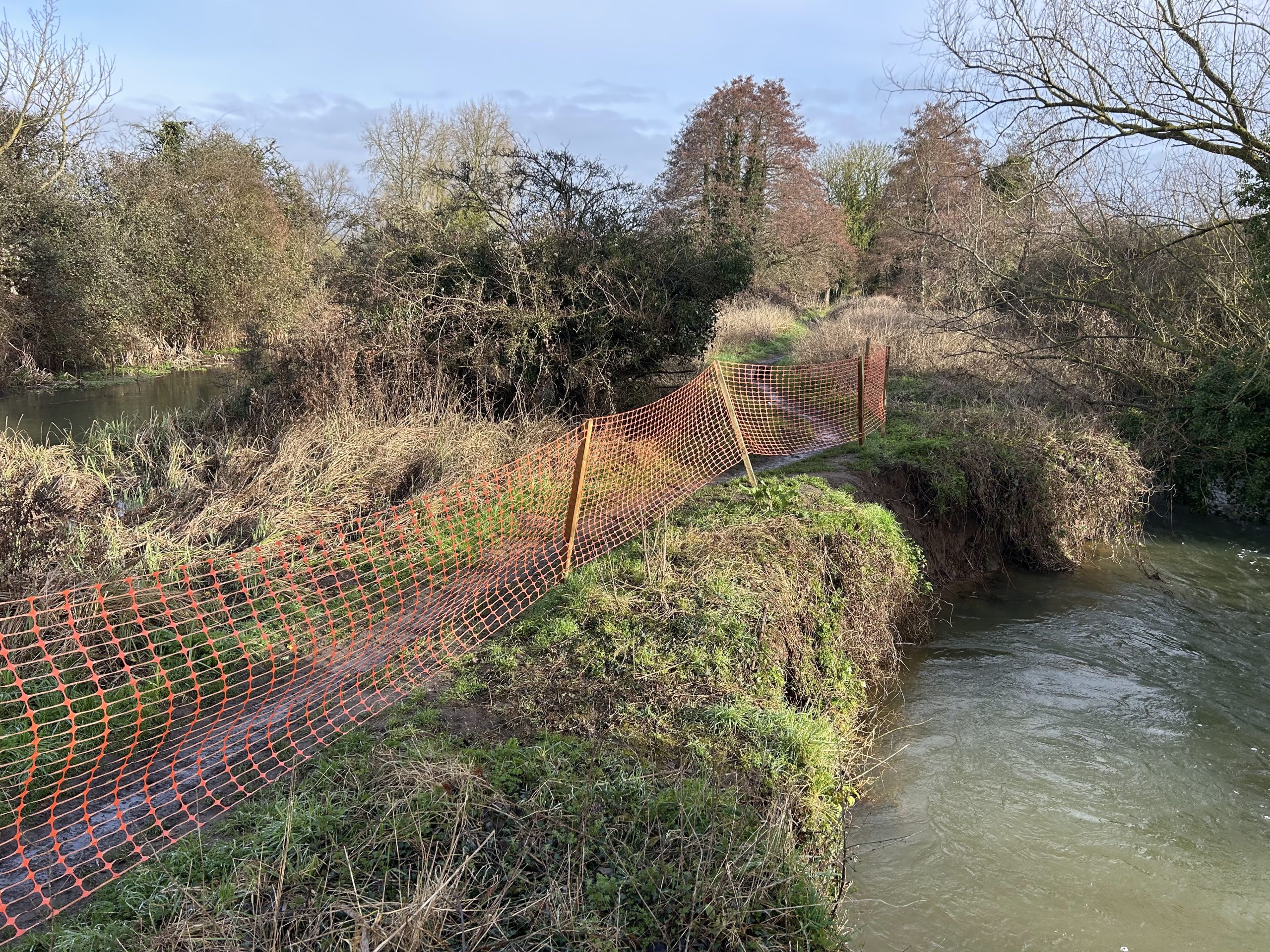
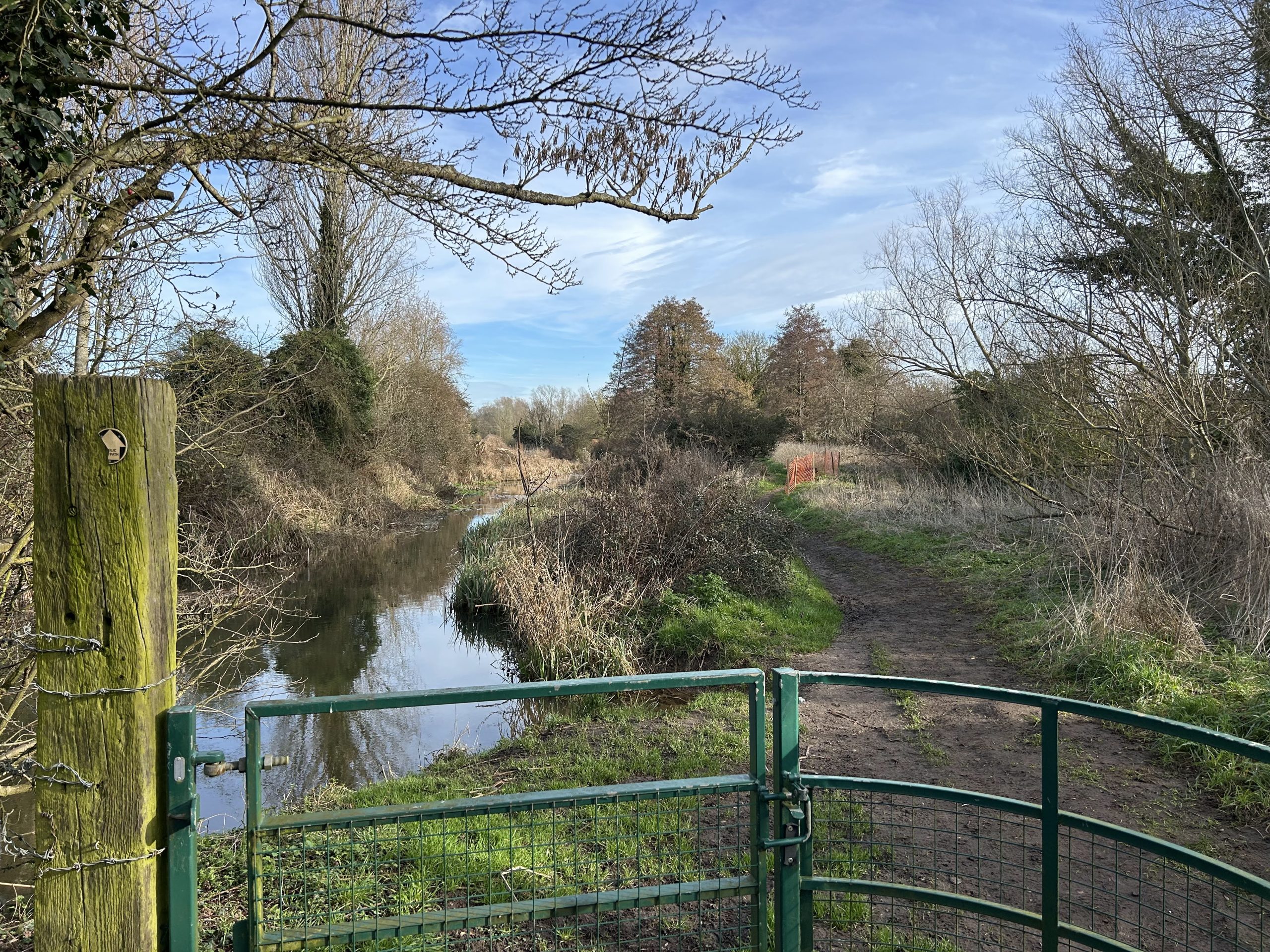
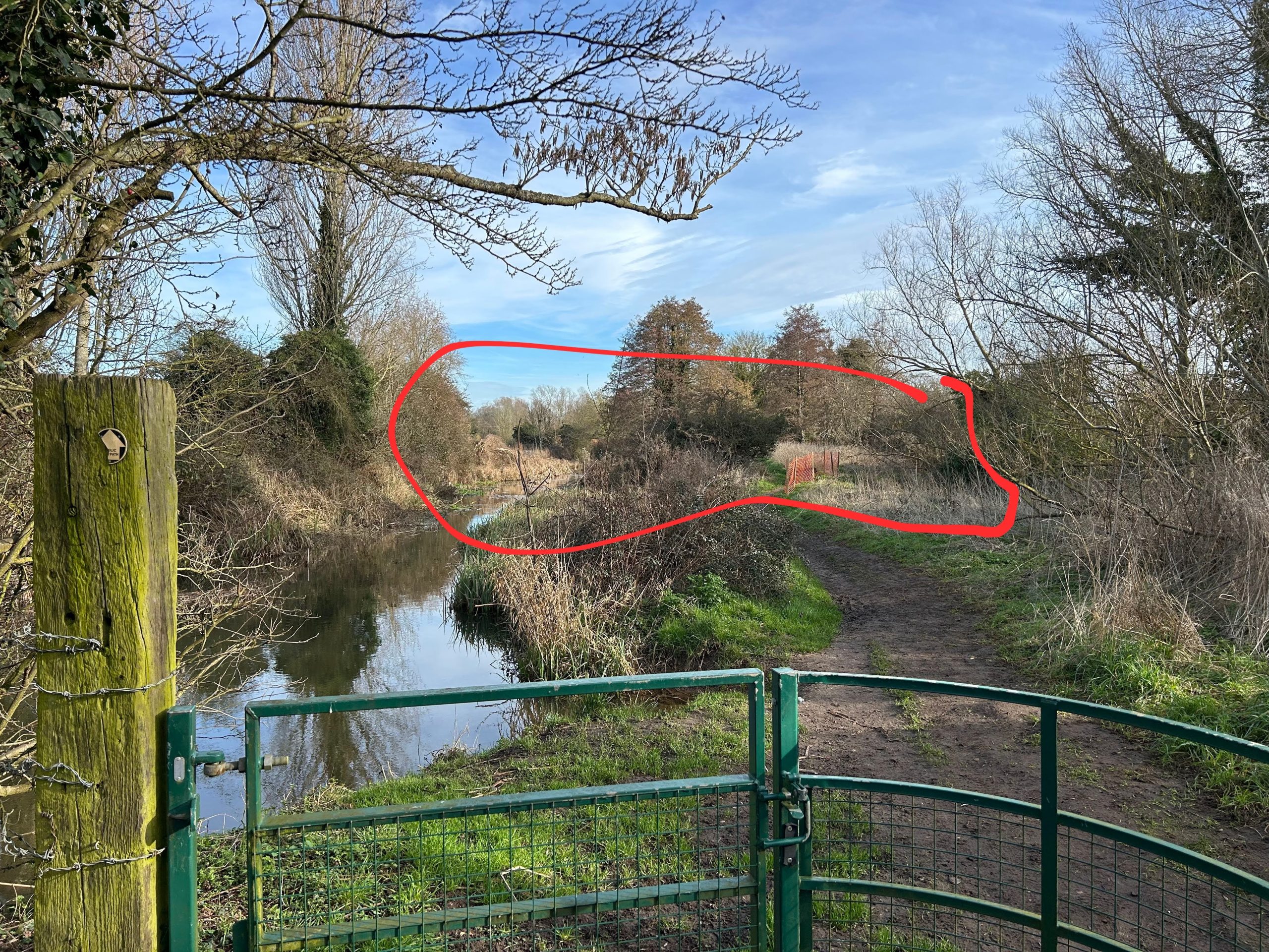
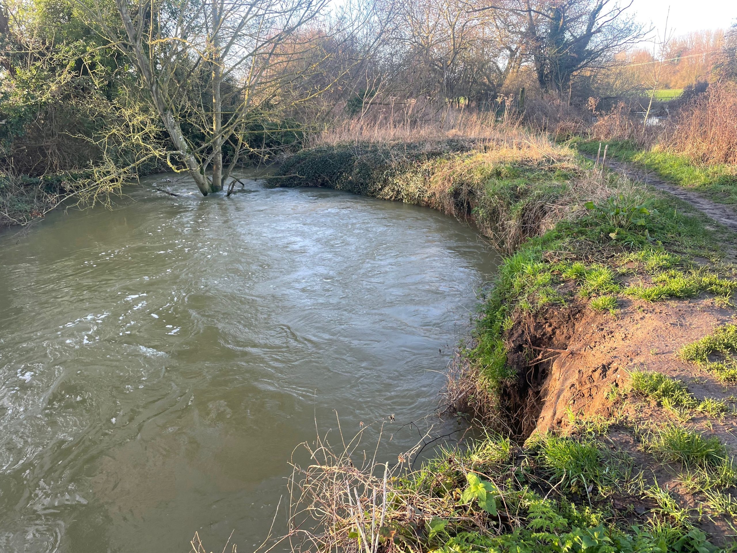
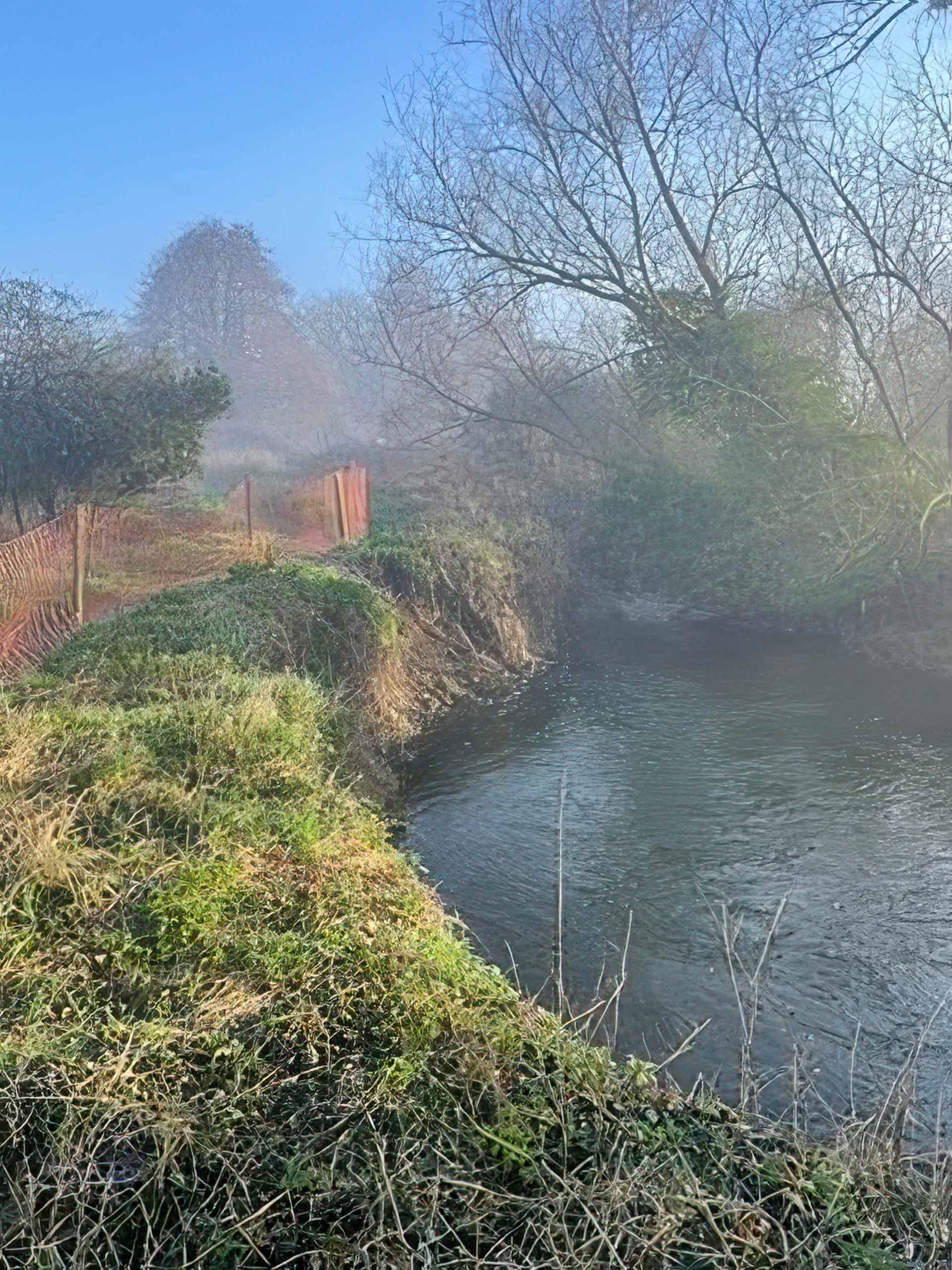
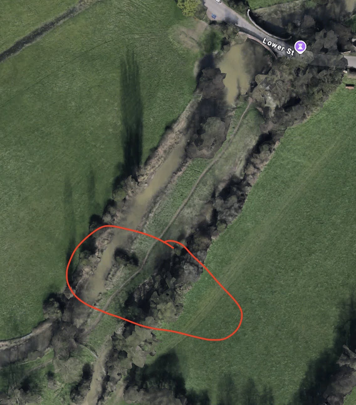
Just south of Hawkeswade Bridge/Ufford Pools, the bank of the “Main River,” the mill stream of Old Melton Mill, is threatening collapse into the side channel six feet below, putting the Lower Ufford/Bromeswell public footpath under threat.
Half of the width between the two water courses has been lost in the past three years due to pressure caused by heavy rainfall, resultant water flow and flooding. Without attention this summer, it is likely to collapse during the next winter flooding season. The Environment Agency and Suffolk County Council are aware of the issue and the latter has erected temporary fencing to allow the footpath to remain open for now.
Parish Council Chair David Findley explained “Ufford’s water meadows play an important role in flood management but become saturated more quickly now; some side channels are eroding away with the force of floodwater. You can see this on the footpath to North Meadow. If the upper channel was breached, much of the water in the mill stream would be lost, triggering a local biodiversity crisis.”
Slideshow – images (click right and left arrows to view)

With thanks to all those who contributed to this article’s text, photos and media and to the volunteers and specialists doing the hard work!