By Sarah Zins
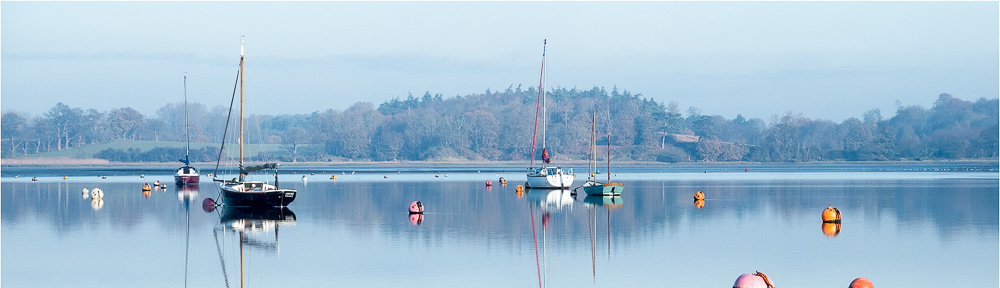
Few people, busy tacking their boat round a buoy or walking along the river path, stop to consider who owns the river, but once the seed of the question is sown, it becomes a source of fascination.
And the main answer is an easy one, but the little issues round the edges (sometimes literally) are knottier. So to the Easier One – the river is owned by the reigning monarch “in right of the Crown”, which means for the duration of their reign. It is not, however, the monarch’s private property and cannot be sold by them, nor are its revenues theirs. As you might imagine, the monarch is not rolling up their sleeves to discuss matters estuarine on a daily basis, so The Crown Estate is tasked with managing rivers and much other property in England, Wales and Northern Ireland. There is a separate Scottish Crown Estate which manages seabed and coastline around the Scottish coast.
The current arrangement began in 1760 on the accession of George III. At that point the monarchy was virtually bankrupt having funded a succession of wars and a wide range of other public services such as the judiciary. The revenues of the Crown Lands were surrendered to parliament in return for the Civil List (now the Sovereign Grant). Each successive monarch has made the same ‘deal’ with parliament and the nation. King Charles III repeated it in his accession speech made at St James’s Palace on 10 September 2022 where he declared “I take this opportunity to confirm my willingness and intention to continue the tradition of surrendering the hereditary revenues, including the crown estate, to my government for the benefit of all, in return for the sovereign grant, which supports my official duties as head of state and head of nation.”
The Crown Estate is an independent and commercial business established by The Crown Estate Act of 1961. It is not owned by the government. All of its profits – which were £ 312.7 million in the year to 2022 – go to the Treasury. It owns the Windsor Estate, a number of retail and leisure destinations, rural and coastal holdings and, pertinent to this article, almost all of the territorial seabed around England, Wales and Northern Ireland to 12 nautical miles. Its purpose is stated as being to create lasting and shared prosperity for the nation and its values are to be caring, together, creative and impactful. The website (www.thecrownestate.co.uk) has more about how it delivers its purpose and put its values into practice. It awards seabed rights (for example to wind farms) and provides licences for the extraction of marine sand and gravel and minerals mined beneath the seabed.
Most importantly to the Deben and other rivers within its ambit, it manages around half of the nation’s foreshore, which is the land between mean high and mean low water mark. It also manages the beds of many tidal rivers and estuaries. In this capacity it leases and licences tidal land and seabed for port and harbour infrastructure, moorings and marinas, pipelines and outfalls.
High Tide
Low Tide
At this juncture, I think it is useful to be very clear about mean high and mean low water. The height of mean high water is the average height between mean high water springs (usually around the middle of the day) and mean high water neaps (around 6 am/6 pm). The height of mean low water is the average height between mean low water springs and mean low water neaps. The average is taken throughout a year measuring the average of the heights of two successive high/low waters within a 24 hour period when the range of the tide is greatest/least respectively. Both springs and neaps occurring roughly fortnightly to coincide with a full/new moon, in the case of springs, and a 1st and 3rd quarter phase of the moon in the case of neaps
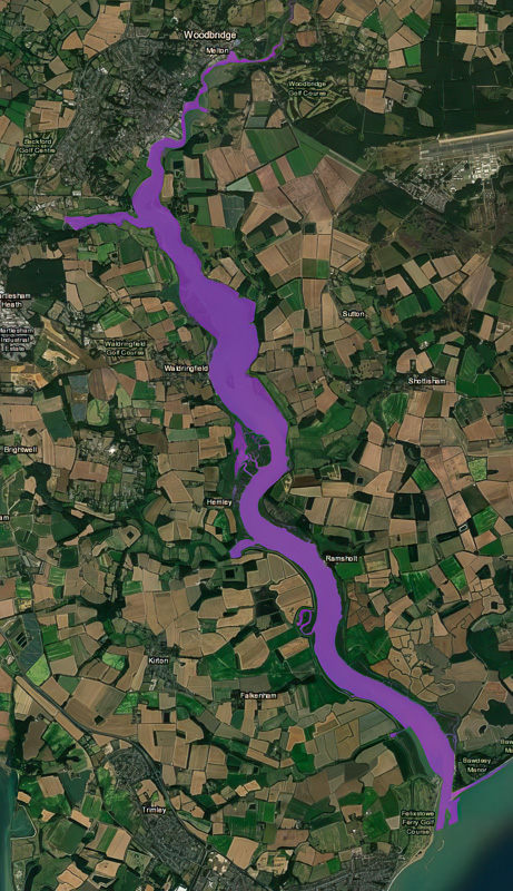
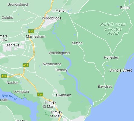
There is a useful map on the website called the Crown Estate Foreshore and Estuary Map which shows the foreshore in its ownership. This is a fascinating resource and colours all of its ownership clearly in a bright purple. But this leaves some surprising gaps in The Crown Estate’s ownership. I will come onto those as they relate to our river later, but a quick glance at Suffolk shows the Orwell as Not-purple, together with the stretch of coast from the mouth of the Deben to Little Oakley south of Harwich. In 1519 Henry VIII gave the rights of the River Orwell to Ipswich Corporation, which consisted of the merchants and port men who ran the town, then the most important trading port in England and a major shipping and distribution centre to London and Europe for Suffolk wool. He may have been persuaded to do so by Thomas Wolsey, whose home town was Ipswich and who at that time was on the ascendant in Henry’s court. The Orwell is not the only tidal river in England, Wales and Northern Ireland not owned by the Crown Estate. The River Colne was gifted to then Burgesses of Colchester in 1189. Parts of the Rivers Ore, Blythe, Blackwater, Crouch and Roach are also not part of The Crown Estate. Trinity College Cambridge owns the Trimley Estate which includes some of the land on which Felixstowe Container port is sited, although the port itself and Harwich International Port is owned and operated by Hutchison Ports UK. Those parts of the ports which are on Crown seabed are leased from The Crown Estate.
You will see on the Foreshore Map a caveat that it is subject to accretion and diluvion. Accretion is a gradual process and diluvion (sometimes also spelled as diluvian) is defined as any geographical deposit produced by a flood of more than ordinary power. When the sea advances or retreats by a gradual process of change (accretion), ownership changes accordingly. So if land ceases to be tidal it becomes the property of the adjacent landowner. Conversely if it erodes and naturally converts to tidal, it becomes the property of the tidal landowner, who is often the Crown. In the case, though, of diluvion – a sudden and immediately visible change such as the breach of flood defences in a storm (as happened at the Lantern Marshes on the River Alde in the 2013 tidal surge) – the ownership remains as it was unless alternative agreements are made. The same is the case where changes occur as a result of human action such as reclamation or digging out basins. So, for example, you will note from the map that neither the Tide Mill Marina nor the Robertsons basin are purple as they have been dug out or reclaimed.
The Crown’s ownership of tidal lands are subject to the public rights of navigation and fishing which have their origins in the Magna Carta. Hence permission is not required to navigate or to catch fish. The Crown Estate does not own the water column, merely the land over which it flows.
The Crown Estate outsources the management of the seabed, the foreshore in its ownership and tidal river beds to a series of specialist managing agents. In East Anglia and on the River Thames, the manager is Morley Riches and Ablewhite (the “Crown Manager”). Its role includes environmental management and granting or refusing consents for moorings, marinas, pipelines, cables and outfalls, wildfowling, reclamation and structures such as jetties and pontoons. Coast protection and environmental management are outside the scope of this article, but the areas for which the Crown Manager is responsible are dealt with below.
Marinas and Reclamation
The Crown Estate is only responsible for this to the extent that any development encroaches on the foreshore which it owns and building marinas/reclamation are subject to the rules surrounding diluvion outlined above. Of course, there are a myriad of other entities who are required to consent to changes which might take place to the river and its environs, and these include the Environment Agency, Suffolk County Council, East Suffolk Council, the Marine Management Organisation, Natural England to name but a few. The Crown Estate is a landowner, not a regulator so any consent it grants is merely for the use of its land and is subject to statutory consents.
Pipelines and cables
The recent East Anglia One cable laid under the river Deben between Bawdsey and Falkenham required The Crown Estate’s consent, as well as the consent of the many landowners whose land on either side of the river was affected by the earthworks involved.
Outfalls
There are 3 main sewage treatment plants near the Deben – in Melton, Woodbridge (Martlesham) and Alderton, all with treated effluent discharged directly into the river. These are operated by Anglian Water, and are the subject of some controversy as to the quality of the effluent (see previous articles published by the RDA on the topic of water quality). All outfalls, whether from sewage treatment plants or private septic tanks, are required to obtain consent from the Environment Agency and will require permission from The Crown Estate for pipes on its land.
Moorings
There are over 1000 moorings on the River Deben. Their regulation and allocation is in the main further outsourced to four fairways committees along the River Deben. Fairway Committees were first established on the river in the late 1950’s in response to problems presented to navigation by the proliferation of moorings. With no harbour authority, individuals could lay moorings at will. As the name suggests, the principle aim of a fairway committee is to preserve a fairway for navigation by controlling the position of moorings. The structure for a fairway committee was first established by the Department of Transport. It is intended to be broadly representative of the river user community and must include a member who is publicly elected to the relevant parish or district council to ensure public accountability. A fairway committee is required to make regular returns to Trinity House to confirm the maintenance and position of channel markers and other Aids to Navigation. Each committee enters into a lease with The Crown Estate as owner of the foreshore and bed of the river. The lease gives the committee the right to grant licences allowing boat owners to lay moorings.
The Fairways Committees are (from source to mouth):
- Kyson Fairways committee -managing most of the moorings from the Tide Mill to Methersgate Quay and in Martlesham Creek up to the Old Rectory Jetty. The previous Knoll Fairway Committee was transferred to the Kyson Fairway committee in 2016;
- Waldringfield Fairway Committee – managing most of the moorings from Methersgate Quay to Early Creek;
- Ramsholt Fairway Committee- managing the moorings from Early Creek to a line level with Red House Farm; and
- Felixstowe Ferry Fairways Committee – managing the moorings from a line level with Red House Farm to a line level with Felixstowe Ferry Sailing Club.
Informally the moorings and fairway markers from Wilford Bridge to the Tide Mill are managed by Melton Boatyard.
There is an Association of Deben Fairways, although they have only met on rare occasions. Some of the Fairway Committees work hand-in-hand with a harbour master, who may for example be tasked with approving mooring tackle, keeping an incident book etc and this is the case with all but the Kyson Fairways committee. Waldringfield Fairways committee works with Anthony Lyon (who was previously with Trinity House for 22 years), Ramsholt Fairway Committee with George Collins and Felixstowe Ferry Fairway committee with John White.
Woodbridge Town Council signed a long lease from The Crown Estate last year for the foreshore between the Tide Mill up to and including the Whisstocks slipway and there is a harbour master for this area, although as it is not dredged, there are few boats mooring other than visitors who leave before the tide recedes.
Other entities which either own moorings or lease them from The Crown Estate include Melton Boatyard, Robertson’s Boatyard, Woodbridge Boatyard, Waldringfield Boatyard, Woodbridge Quay Company, Martlesham Creek Boatyard and Deben Yacht Club.
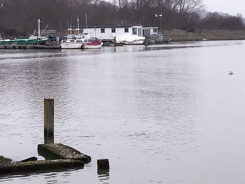
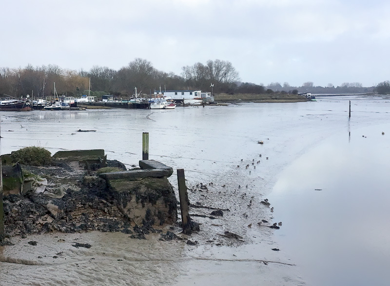
Houseboats and Pontoon Berths
There are around 84 houseboats on the river and over 300 pontoon berths. Most of the pontoon berths are located at the Tidemill Yacht Harbour, but there are other pontoon berths as well as houseboats at most of the boatyards along the river. Some boat owners own the land behind the river and have a right to access their houseboats, but not to put a structure on the foreshore without a licence. In the past, Suffolk Coastal District Council leased some of the foreshore from the Tide Mill to Wilford Bridge, so regulated the houseboats on the foreshore, but they allowed their licence to lapse and the Crown Estate is in discussions with houseboat owners who do not have a current licence.
Channel Buoys and the Channel
The Corporation of Trinity House was incorporated by Royal Charter in 1514 and is now a charity dedicated to safeguarding shipping and seafarers, with a statutory duty to deliver reliable, efficient and cost-effective aids to navigation service for the benefit and safety of all mariners. It is responsible for ensuring that the marker buoys for the mouth of the river are in the correct position, no mean feat for the Deben, where the channel at the mouth can change radically from year to year and even month to month as the knolls shift. The channel markers from the Rocks and upstream are positioned and maintained by the Fairways committees at their expense, but the inspector of seamarks from Trinity House visits annually to check the condition of the buoys.
The river bed in the channel is hard gravel and its depth had not previously changed significantly for 30 years, but since around 2017 it has been starting to show signs of siltation upstream from Methersgate Quay and the channel has moved in some parts.
Access Structures (jetties and pontoons etc)
In addition to requiring The Crown Estate’s consent for access structures which are laid on the foreshore it owns, any structures also require consent from the Marine Management Organisation (MMO). The MMO was created in 2009 by the Marine and Coastal Access Act. It says this of itself: “Driven by government’s aim for clean, healthy, safe, productive and biologically diverse oceans and seas, MMO’s purpose is to protect and enhance our precious marine environment, and support UK economic growth by enabling sustainable marine activities and development.” The MMO’s responsibilities include fisheries management, marine planning and marine licensing. The categories of activity that may need a marine licence are:
- Construction (including cable-laying and maintenance, alteration or improvement of existing structures and assets)
- Dredging
- Deposit, removal or incineration of any substance or object
- Scuttling (sinking) of any vessel or floating container
- Use of explosives
As well as dealing with major harbours such as the Port of London and Dover, it has interpreted its remit very widely to include marine licences in mostly non-commercial rivers. Licences are therefore required for any dredging in the Deben or the smallest pontoon or jetty. The MMO is very expensive to deal with, rigidly bureaucratic and very slow in its responses.
Wildfowling
The Crown Estate grants sporting leases for wildfowling on its foreshore in line with national conservation-related legislation to ensure that any hunting is sustainable and compliant. The Anglian Wildfowlers Association is the only club to have a licence to shoot on the foreshore of the Deben. Members are obliged to give an annual return for every expedition undertaken, even if no birds are shot. Shot must be non-lead. The process for the grant of a sporting lease is overseen by the Joint Tidal Group run by the British Association for Shooting and Conservation. Further details are available on The Crown Estate website.
The Knottier Bits
Well, if the land owned by The Crown Estate is the easy bit, how long will the next section be? In fact, surprisingly short until anyone can update the author about other ownerships.
Let’s again pick off the low-hanging fruit. The river above tidal waters belongs to the landowner on which the river is situated. For this purpose, The Crown Estate relies on the tidal limit provided by the Ordnance Survey. There may be some dispute about where the water ceases to be brackish, but the purple mark clearly stops on a line between Ufford Park Golf Course and just above Bromeswell village.
But there are a number of exceptions to the rule outlined above and they are as follows, again from upstream to the mouth:
- A small area next to Bromeswell village where the 4 acre common extends onto the saltings:
- Spinney marshes – the large area of flooded land opposite Larkmans’s Boatyard, owned by the National Trust. This was flooded by an exceptionally high tide in 1938, so stayed in its existing ownership under the diluvion rules outlined above;
- Very large areas of foreshore on the East bank by Little Thatch and from Dairy Farm to the National Trust Woodland opposite the Tide Mill Marina, also owned by the National Trust;
- At Hemley, the intertidal creeks are owned by the Crown Estate, but the saltings are owned privately by James Hayward and Patrick Bowden-Smith. The river wall at Hemley Point broke several times and very badly in 1938 and was finally abandoned in 1939 after attempts by the Environment Agency to mend it were washed away;
- Further towards Kirton Creek, the saltings are owned by Michael Paul. Robert and Jonathan Simper own a small piece of salting on the south side of the “new” Shottisham creek and the top of the Rocks beach. Just north of Ramsholt and at Bawdsey the saltings may be owned by the Adeane estate;
- There is a significant area just north of Felixstowe Ferry jetty which is owned by the Felixstowe Foreshore Trust (FFFST).
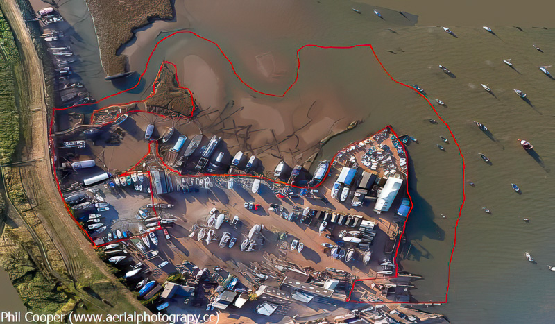 This was the subject of an article by Tony Storer, the then FFFST secretary, in the Deben magazine 53, Autumn 2016. In a nutshell, the land previously belonged to the Lady of the Manor, Connie Jenkins, who offered if for sale by tender in 1991. A group of around thirty people (including the RDA) with a common interest in preserving the unique character of the foreshore at Felixstowe Ferry joined together in a bid to purchase the land. The land in question is essentially the mud and shingle between mean high and mean low water extending from the foot ferry jetty and around the boatyard in a northerly and then westerly direction right up to the river wall. Also included are two areas of land within the boatyard above the high water mark. The aerial photograph taken in August 2016 shows the extent of the land in question. Following the acquisition of the land the FFFST was formed in early 1992 with its stated objectives being to” maintain the essential character of the Felixstowe Ferry Foreshore, to maintain access to the river for recreation and business and to control commercial development.” There are three trustees and the trust is run by a management committee of eight to ten member. There are currently shares available for around £500 each – for further information contact the FFFST at [email protected]. There are currently 18 houseboats moored on the foreshore and all monies raised through houseboat licences and land rent is used to further the trust’s aims.
 - The knolls and coastline to Felixstowe were part of the Manor of Walton Cum Trimley and Felixstowe Priory.
So next time you set sail or walk the dog, you may view the river with fresh eyes. And do please report back any updates on the ownership situation.
The author thanks Peter Riches, managing agent for The Crown Estate in Suffolk, for his invaluable input into the aspects of Crown ownership and Robert Simper for his help in compiling the private ownership of parts of the river. However, all views expressed here are the author’s own.
Sarah Zins
 Sarah Zins was variously membership secretary, Chair, Vice-Chair and Co-Chair of the River Deben Association between 2016 and 2022. She lives by the Deben and enjoys the river in all its forms – sailing on it in her Topper, rowing in her tender. swimming near the mouth and walking round the footpaths. Sarah is retired and when not engaged in watery activities, she volunteers for a couple of local charities.