Editors Note
One of the most striking exhibits at the Waldringfield Tidelines exhibition in August 2025 was a set of posters produced by Bob Crawley and summarising his research into the Deben sea walls. Although Bob admits that the work has raised more questions than it has answered — and therefore his findings are provisional — the beautifully presented posters will certainly open many people’s eyes to a feature we too easily take for granted.
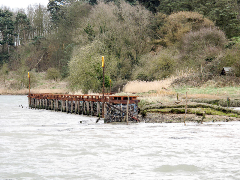
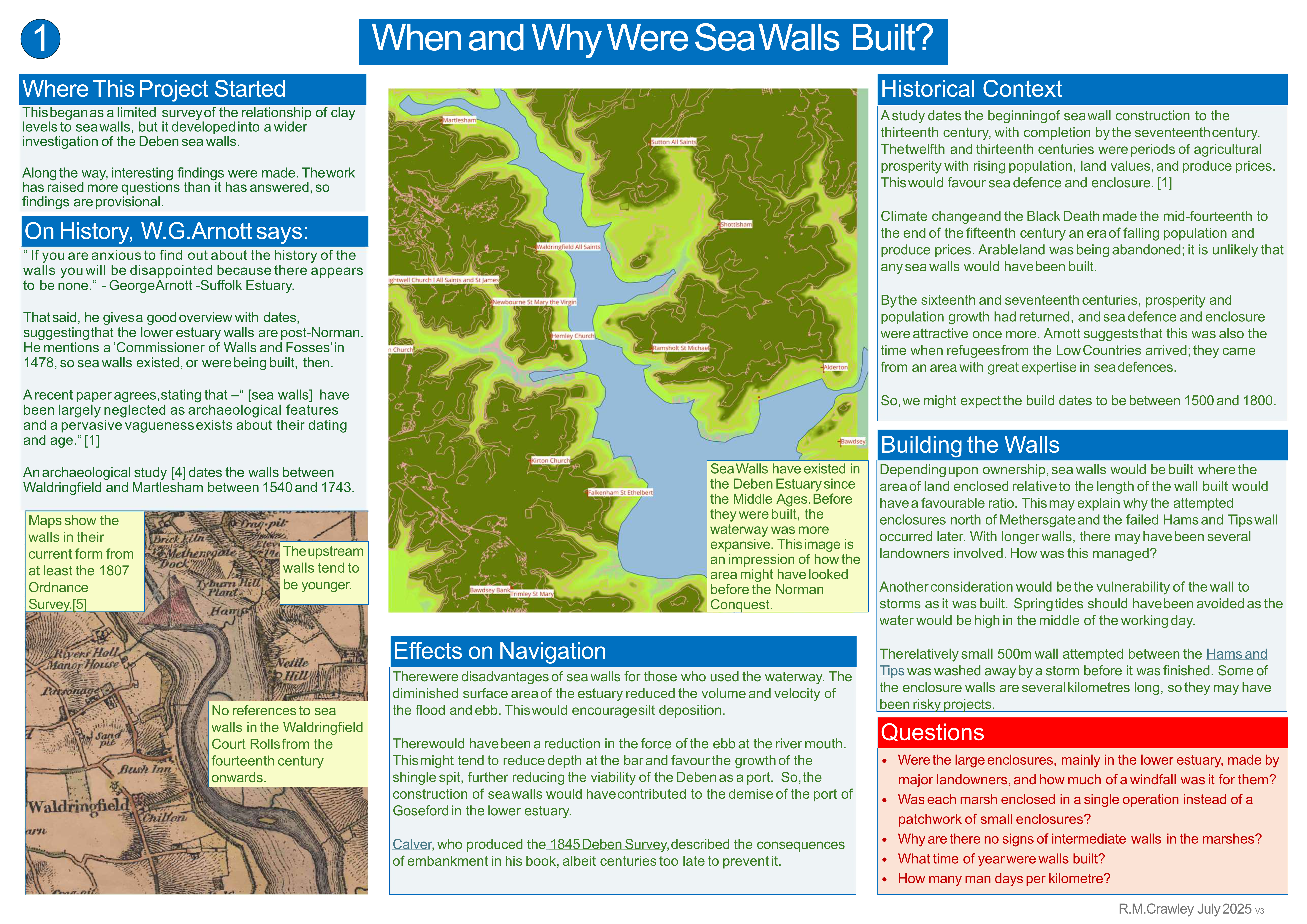
- Poster 1 asks When and Where were the Sea Walls Built?
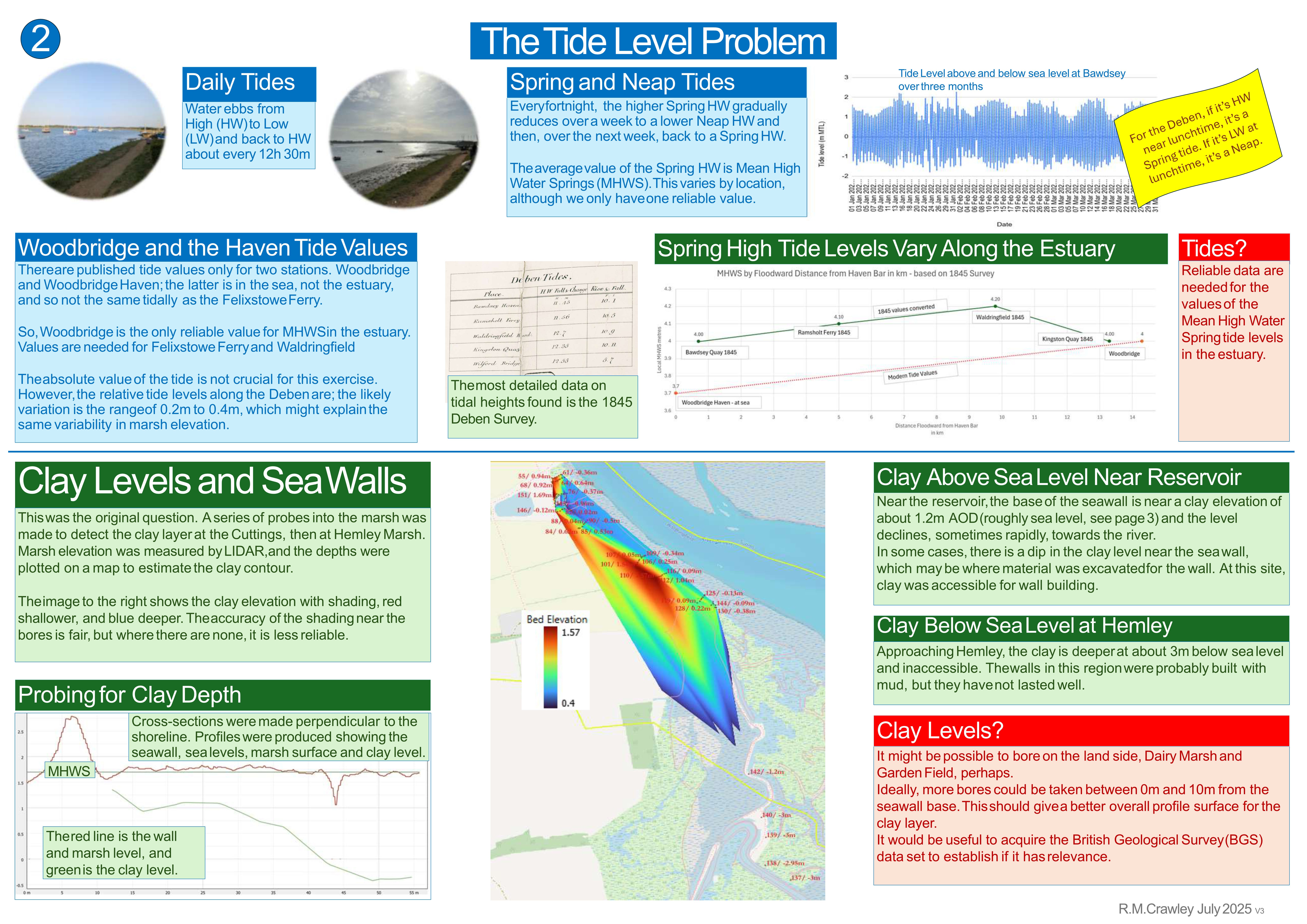
- Poster 2 discusses The Tide Level Problem
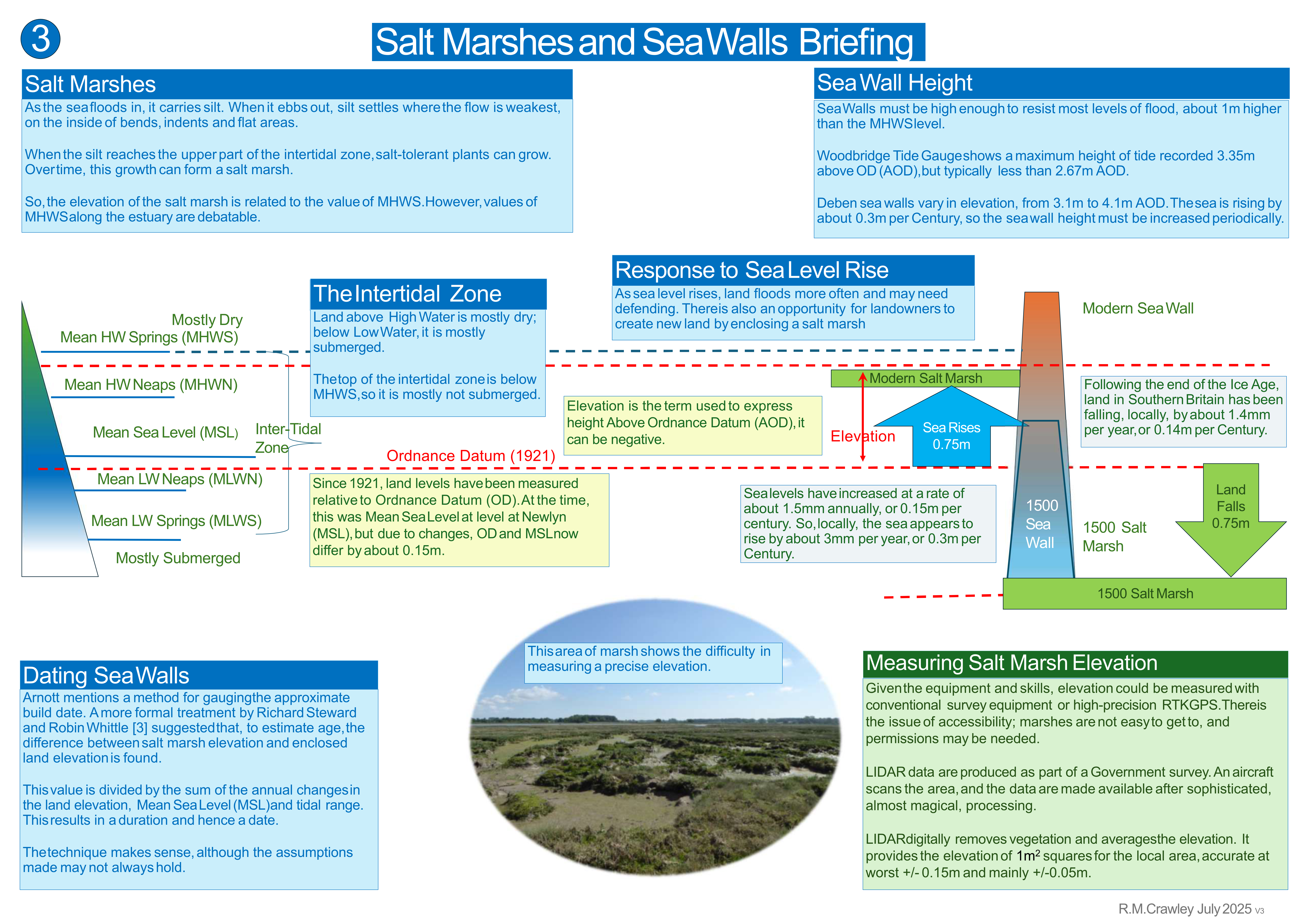
- Poster 3 offers a Salt Marshes and Sea Walls Briefing
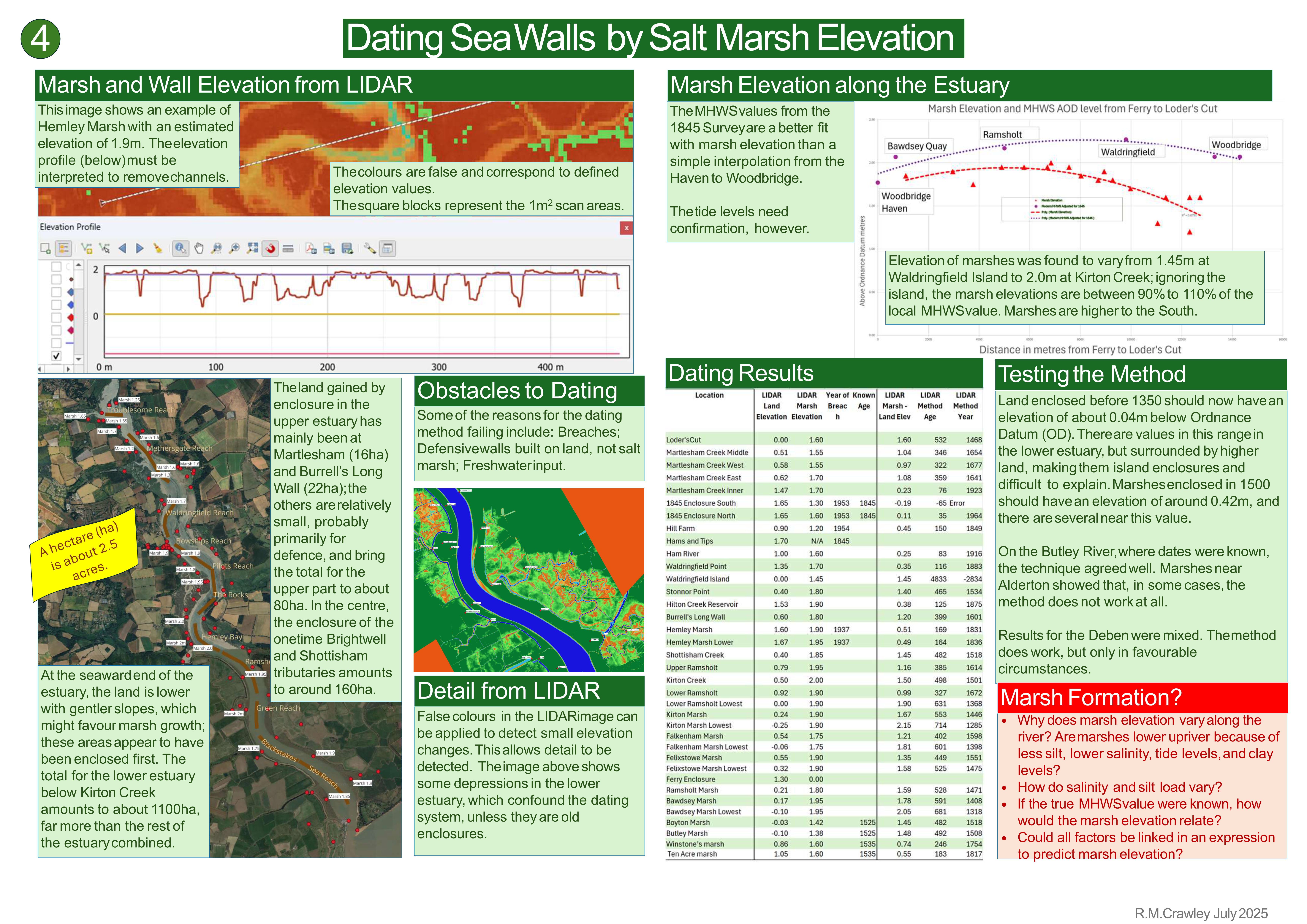
- Poster 4 explains Dating Sea Walls by Salt Marsh Elevation
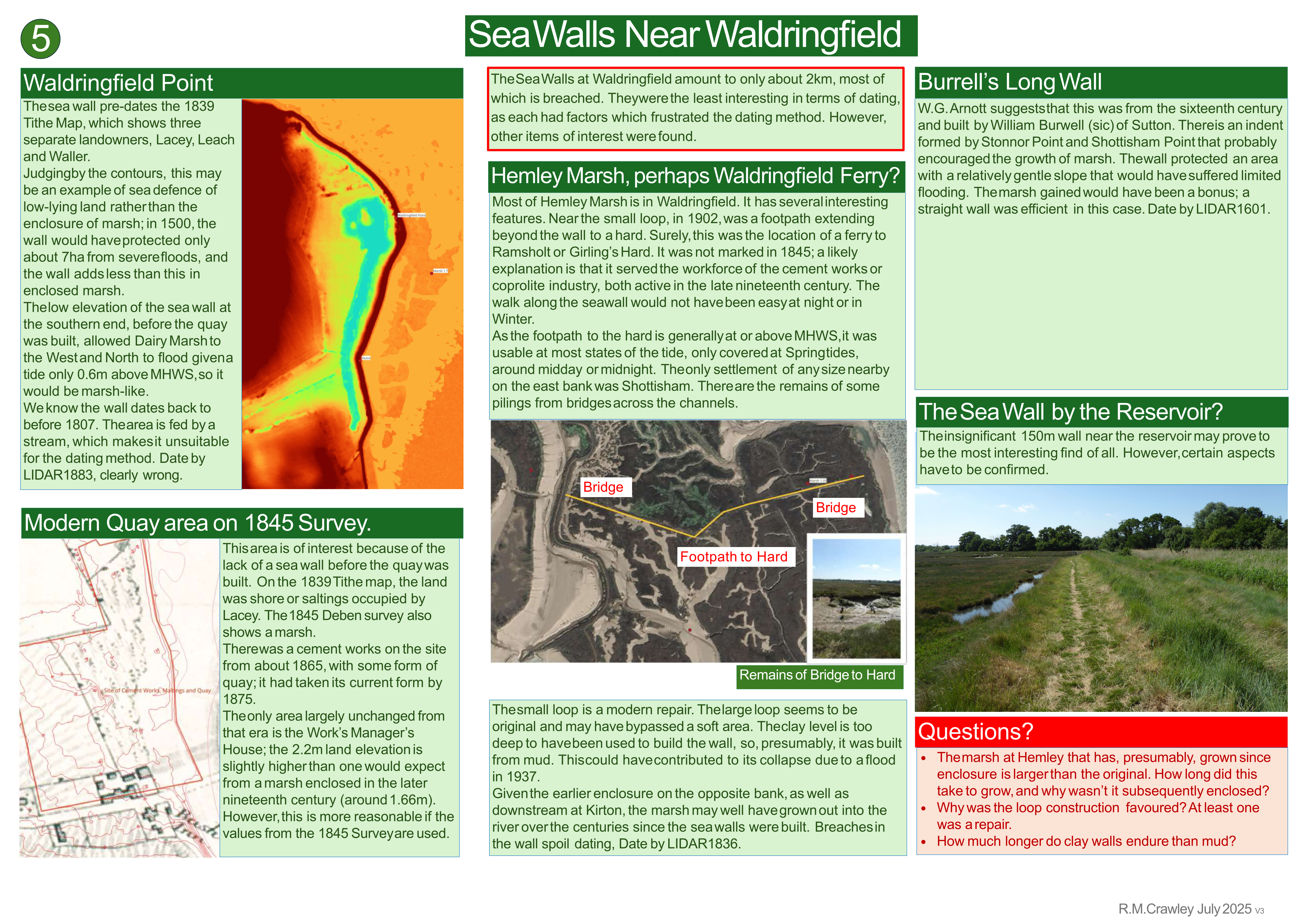
- Poster 5 focusses on Sea Walls Near Waldringfield
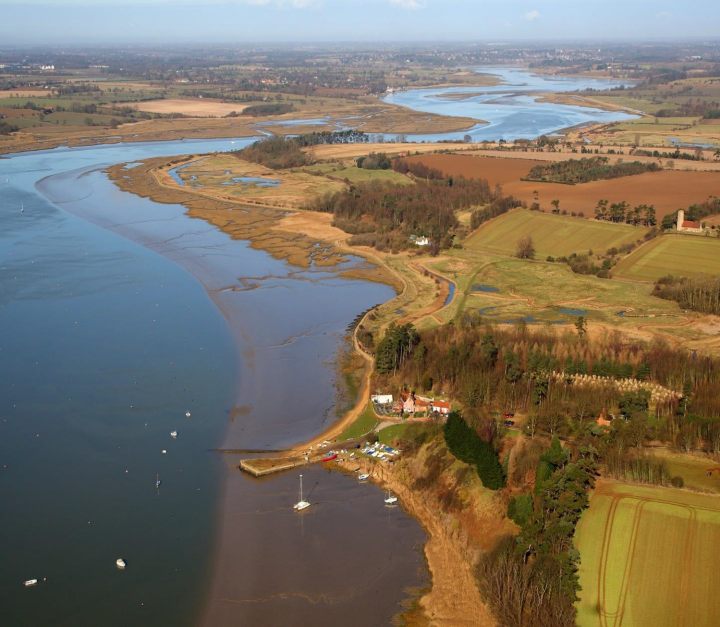
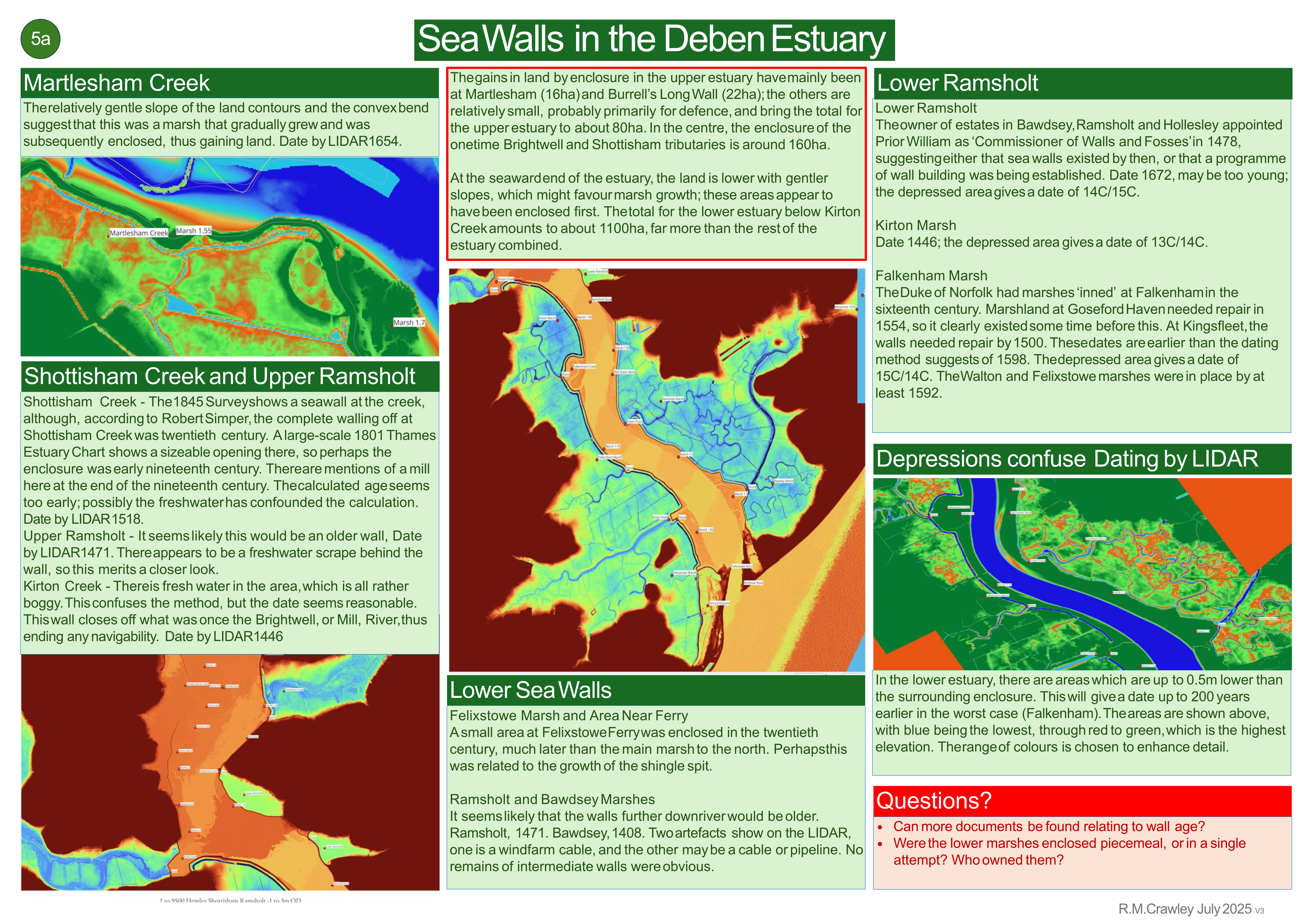
- Poster 5a Sea Walls in the Deben Estuary
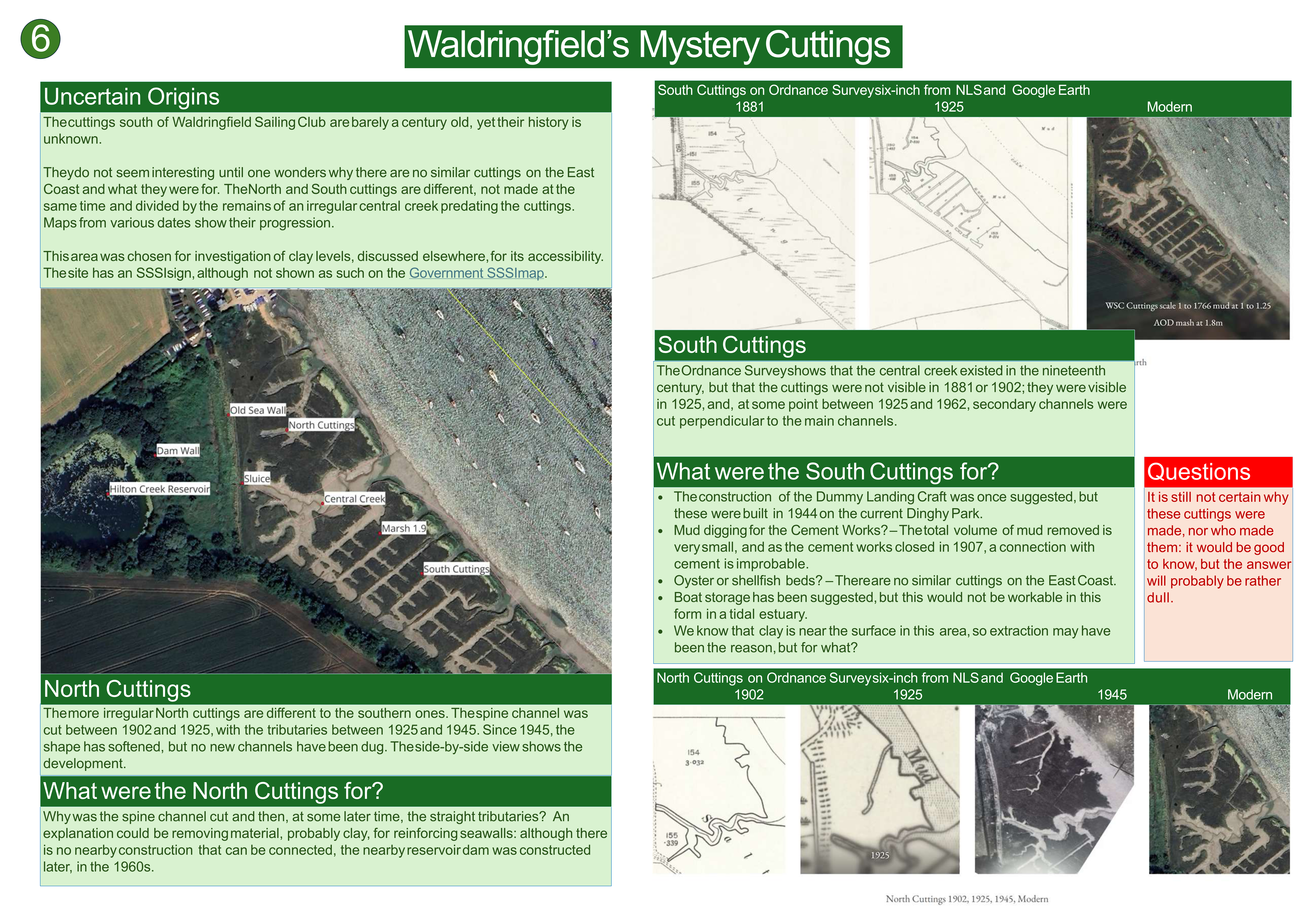
- Poster 6 explores Waldringfield’s Mystery Cuttings
There are references and suggestions for further reading.
By Bob Crawley
This began in early 2025 as a survey of the relationship of clay levels to sea walls, but developed into a wider investigation of the Deben sea walls. Along the way, interesting findings were made. The work has raised more questions than it has answered, so findings are provisional. The results were presented as a slide presentation below or as set of posters for an exhibition held in August 2025, attached <here>.
Bob Crawley
With a background in Computing and Communications technology, Bob Crawley relocated from London to Suffolk in 1987. Being near the North Sea led to wreck diving on the East Coast and other water sports. Later, living in Waldringfield triggered a belated enthusiasm for yacht sailing. This fitted neatly with an interest in the history of our local waters and estuaries, especially the Deben.