By Simon Read
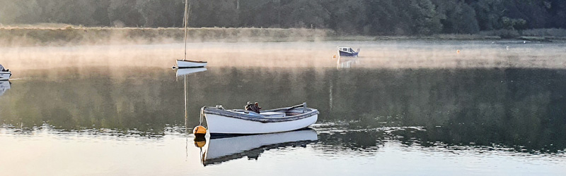
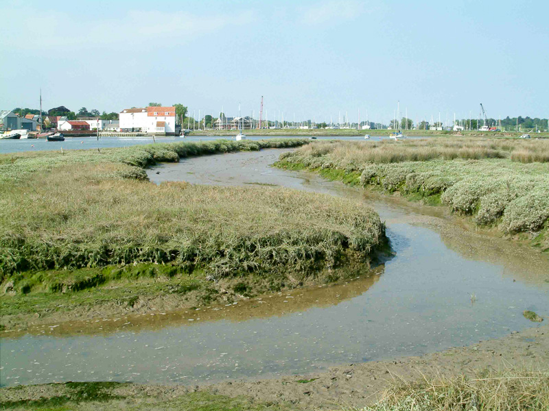
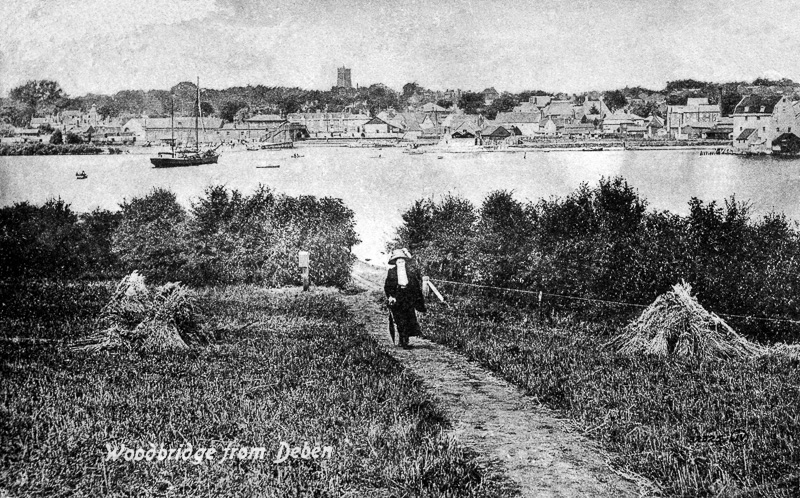
Directly opposite Woodbridge Town Quay, there is a small saltmarsh of approximately 2.5 hectares. This is Sutton Saltmarsh and was the subject of a management project undertaken by the River Deben Association in 2008-2009.
Background:
This project came about by a circuitous route but was initially prompted in 2004 with a request by the Environment Agency for the River Deben Association to become involved in the consultation process towards a new estuary strategy on behalf of the river-based community. The previous estuary strategy, published by the hydrological consultancy Posford-Duvivier, and published in 1999 had demonstrated that we were woefully unprepared to contribute effectively to the decision-making process upon the management of our estuary, and that next time round a substantial effort would be essential for us to be sufficiently well-informed about estuary processes and tidal systems to participate credibly in the process.
At that time, I was a member of the RDA committee and had agreed to represent RDA in the meetings with EA and the preparatory discussions leading to the next iteration of the estuary strategy. Bearing in mind the need to promote a deeper understanding of the complexities of the tidal system and the criteria for its management, I wondered whether there was a way we could reach beyond just disseminating information, which almost certainly would have limited uptake, to generate a project on the estuary that would be simple and affordable enough to be carried out by a community organisation using entirely voluntary labour and would help promote a sense of community ownership and responsibility for the wellbeing of the immediate estuarine environment.
Having lived on the estuary since 1979, I already had a strong insight into our tidal landscape that ambiguous land-but-not-land saltmarsh zone: exposed or awash according to the state of the tide. Despite comprehensive reclamation works from medieval times, the Deben is host to a disproportionately large saltmarsh stock, which is now as much the result of the failure of flood walls causing some flood cells to revert to an intertidal state, as to saltmarsh becoming established through deposition and accretion of sediment in those more sheltered locations outside of the flood walls.
The choice of Sutton Saltmarsh:
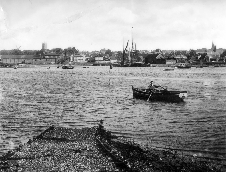
Sutton Saltmarsh owes its existence to a 90metre causeway wall that historically joined the ferry landing hard to the shore and by default gave shelter for a healthy saltmarsh complex to develop downstream from the woods of Ferry Cliff. It is not certain when the ferry was established but it was operating long before Wilford Bridge was built: the first recorded ferryman was one John Beale 1509, and the causeway and ferry hard date from 1874. At a time before motor vehicles, this was an indispensable link with Woodbridge and beyond for the settlements on the Sutton side of the estuary.
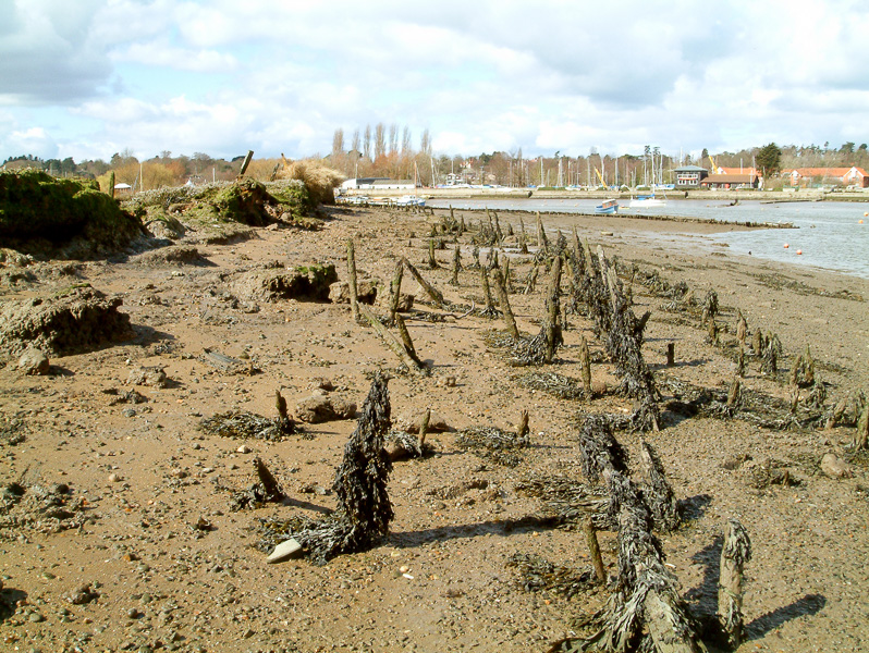
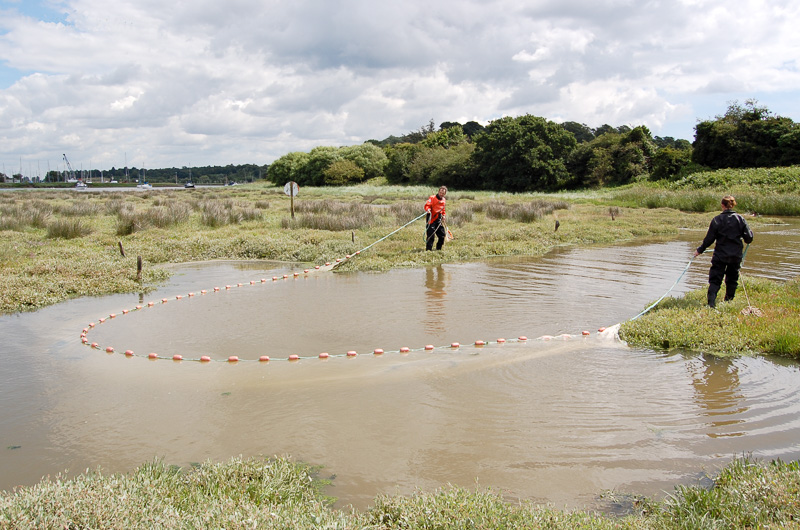
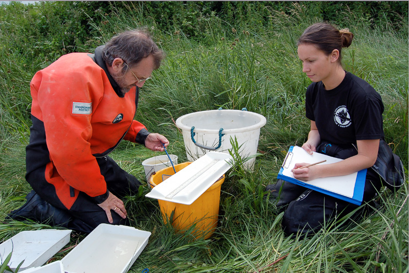
After the 2nd World War, the use of the ferry declined and with it, regular maintenance of the wall and landing hard. In the 1970’s it ceased altogether, and the wall, no longer needed, fell quickly into disrepair until, by the early years of this century, the tide on the ebb had broken through and was starting to erode the saltmarsh behind. If there was ever an appetite for a project to address the vulnerability of saltmarsh to scour and wave action, the Sutton site, as a significant part of the local historical and ecological landscape, would be an ideal candidate. However our initial proposal to put soft engineering works in place to attenuate tidal action was not met with enthusiasm by either Natural England or Environment Agency, and it took some persuasion to overcome doubts over the advisability of interfering with a natural process. This came in the person of fisheries expert Steve Colclough who undertook to net the channel system of the marsh for evidence of its function as a tidal fish nursery. Steve worked over a single tide with the help of a student to net the main channels of the marsh and took a sample of 73 specimens including juvenile bass, flounder, and mullet.
With some judicious lobbying by Trazar Astley-Reid, the AONB estuaries officer, this was enough to secure an agreement that a project could go ahead. There were conditions to be met, which were that any fence structure in front of the marsh had to be permeable and must not be a continuous unbroken fence, so that waders and waterfowl might have freedom of passage through and around the structure.
The project:
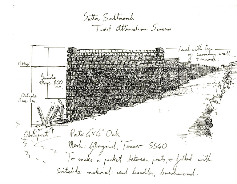
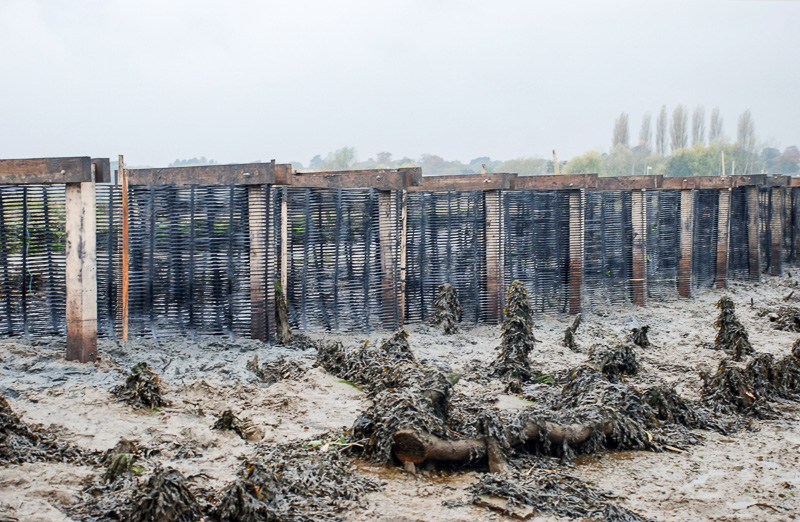
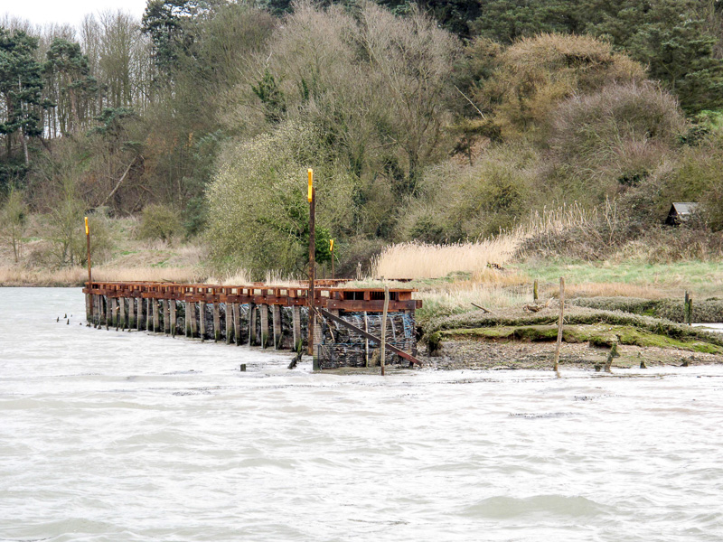
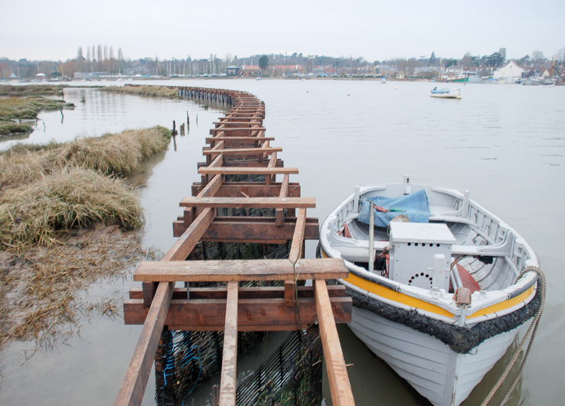
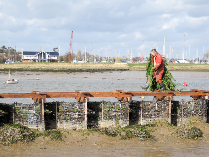
With advice from Andrew Hawes of Hawes Associates, Hydraulic Engineers, we came up with an interpretation that would work well within the agreed constraints: this was a series of freestanding vertical screens set on the foreshore and oriented to offset wave and tidal energy and any scouring effect it may have upon the saltmarsh behind. The completed structure is of 62 individual screens, each made up of two 4”/4” oak stakes, 1.5metres apart, driven into the foreshore to the same height as the crest of the remaining causeway, with a length of heavy duty plastic geogrid (Tensar SS40) material wrapped around each pair of stakes to make up an envelope which, when filled with brushwood serves as a baffle against wave and tidal energy. The baffles are set at 1metre distance apart at 45degrees to the ebb tide and together form a continuous screen along the entire frontage of the site. The entire complex was consolidated by a structural framework of larch to include sections of boardwalk to facilitate monitoring and maintenance.
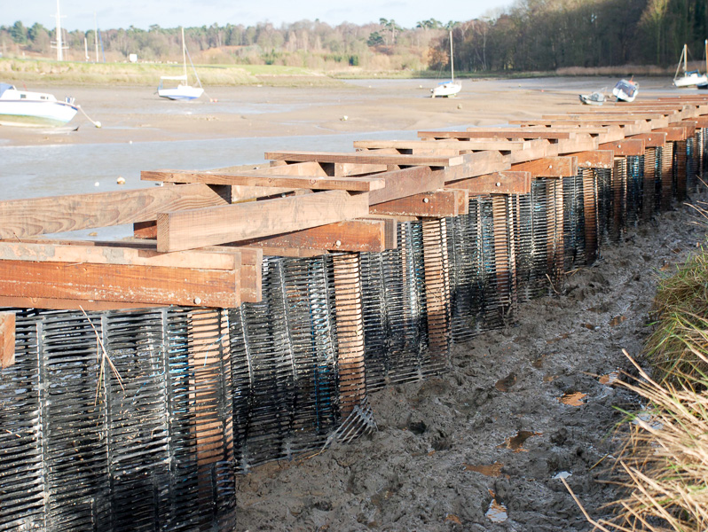
With technical guidance from Andrew Hawes, the structure was built using manual labour and no heavy machinery. For the heavy pile driving task, we were lucky to secure the support of HMP Hollesley Bay Colony, who provided us with a couple of extremely strong and enthusiastic volunteers, all the other work was carried out by local volunteers, very many of whom were members of the RDA.
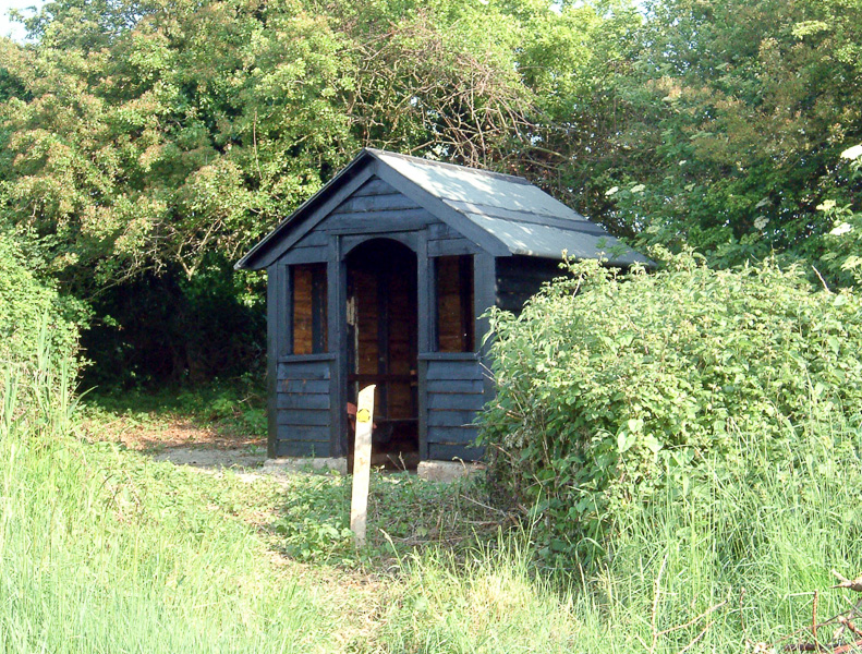
As for all infrastructural work in ecologically sensitive locations, we were obliged to work within a defined time frame that would cause least disturbance to the wildlife. This meant that the allocated period to accomplish the work was confined to a time window of October 2008 to February 2009: this was not the best time of the year to be working on an exposed foreshore, but after some structural repair and a new roof, we were able to press the original ferry hut into use as a shelter during storms and for lunch breaks.
The tidal attenuation barrier was completed in Spring 2009, since when the site has stabilised: it continues to accrete and is host to a complete succession of saltmarsh vegetation. It is of course debatable whether it will keep up with sea level rise or withstand the natural trend of the ebb tide to swing over to the Sutton side away from Woodbridge Town Quay. These are things that we cannot control and to my mind the essence of projects such as this is that there must be a give and take conversation with the natural system. They signify a sense of living and working with the processes of change but should not claim to be definitive restoration projects.
Reflections and the future value of saltmarsh:
We should bear in mind that it is only since the European Habitats Directive of 1992 that saltmarsh became formally enshrined as designated habitat, up until then it was considered fair game for reclamation, a source of raw material to maintain flood defences or a poor man’s marina for winter lay-up. It was considered a kind common land to be exploited in whatever way the community saw fit. Now there is at least a chance to consider how to address what is in essence centuries old bad stewardship, which is a good starting point for projects that set out to stabilise degraded saltmarsh sites or even restore them. It is vital not to ignore the principle of modest projects such as the Tidal Attenuation Barrier for Sutton Saltmarsh: that they are an opportunity for a community to become more conversant with the natural environment through working with it and signal a renaissance in the understanding of the continuity between our behaviour and the effect it has upon the natural systems that surround us.
We have come a long way from those tentative first steps into the intertidal zone and since 2004 interest has burgeoned beyond the realisation of its value as a nutrient rich fish nursery and the understanding of its importance for avian species as high tide roost, feeding and nesting ground. Major studies have been undertaken into the capability of fringing saltmarsh to absorb the effects of tidal and wave energy on flood defence walls, lowering both the ongoing cost of their maintenance and exposure to flood risk and serious consideration is being given to the capacity of saltmarsh to absorb carbon or conversely release it to the atmosphere should it degrade. This has become the subject of a great deal of immediate attention for therein lies the potential for investment in carbon futures or for corporate offsetting, if only a suitable model can be developed.
Simon Read

Simon Read is a visual artist and academic who first came to Woodbridge in 1979 as the proud owner of a Dutch Barge called the Jacoba: this was an extension of a lifetime’s passion for all things maritime and led to a shift away from the appearance of the estuary and coastal environment to an intense interest in how it works. For a life so closely attuned to the rhythm of a tidal river, it was inevitable that this should seep into his practice as an artist, diverting him from the production of studio-based works into commissioned projects, many of which demanded a strong understanding of fluvial or tidal systems. In 1993, by the invitation of the (then) Countryside Commission he became Artist in Residence on the Upper Thames, which gave him the stimulus to follow his curiosity about a location without the immediate constraint of needing to produce signature artworks. For this project he researched the engineering solutions to the control of water-level by weirs in the Thames Valley, which led in 1996 to a large-scale commission: ‘A Profile of the River Thames from Thames Head to Sea Reach’ for the Thames Flood Barrier. This was followed by other commissions, including the co-design and the production of stone carvings for the flood defence works on Poole Town Quay 2001.
The experience of projects demanding an informed approach to the dynamics of very particular tidal environments sensitised him to the importance of interdisciplinary partnership and knowledge sharing, which he has since taken further through academic research projects, most of which have linked in some form to water and wetland management, so it was no small surprise when he seized the opportunity to contribute to the discussion of estuary management on the Deben around the beginning of this century and continues to play an enthusiastic role to the present day as a Trustee Director of the Deben Estuary Partnership.
Simon Read: born 1949, BA hons Fine Art University of Leeds 1973. MA Fine Art, Chelsea School of Art 1975. Lecturer in Fine Art widely in UK and internationally, most recently Associate Professor of Fine Art, Middlesex University London, ret’d October 2022 as an Emeritus Associate Professor of Fine Art.