By Sue Ryder Richardson
Introduction
Some thirty-four miles inland from the mouth of the Deben, the village of Debenham nestles in quintessential Suffolk landscape. It is one of the unspoilt medieval gems of high Suffolk. To the west of the village, around Mickfield meadow, lies the source of the Deben, a sometime trickle of water in a field of flowers.

Debenham high street.
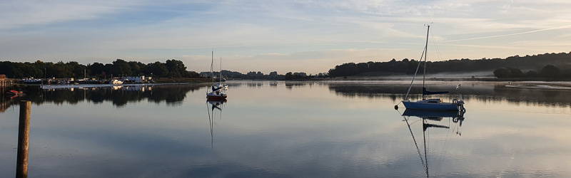
Travel inland, leaving the tidal estuary behind, to where the Deben becomes smaller. It makes broad arcs through the lush pastures of Ufford and Wickham Market, turning to gentle meanders between Kettleburgh and Cretingham, until finally, only a smudge of trees is left to indicate its path along Thorpe Lane into Debenham. It is scarcely credible that this tiny stream was once navigable to Debenham, but it is perhaps a bonus that a planned canal in the Victorian times failed to be built, as did the railway, hence Debenham’s peaceful demeanor.
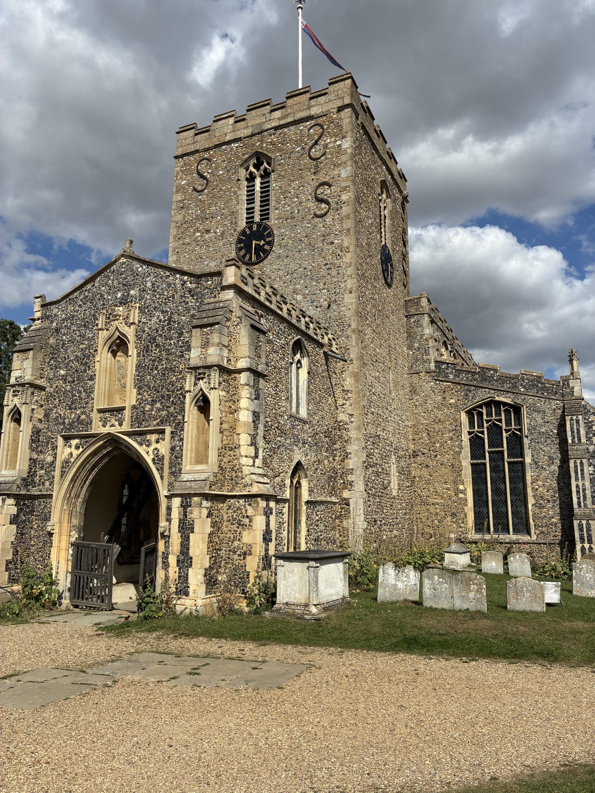
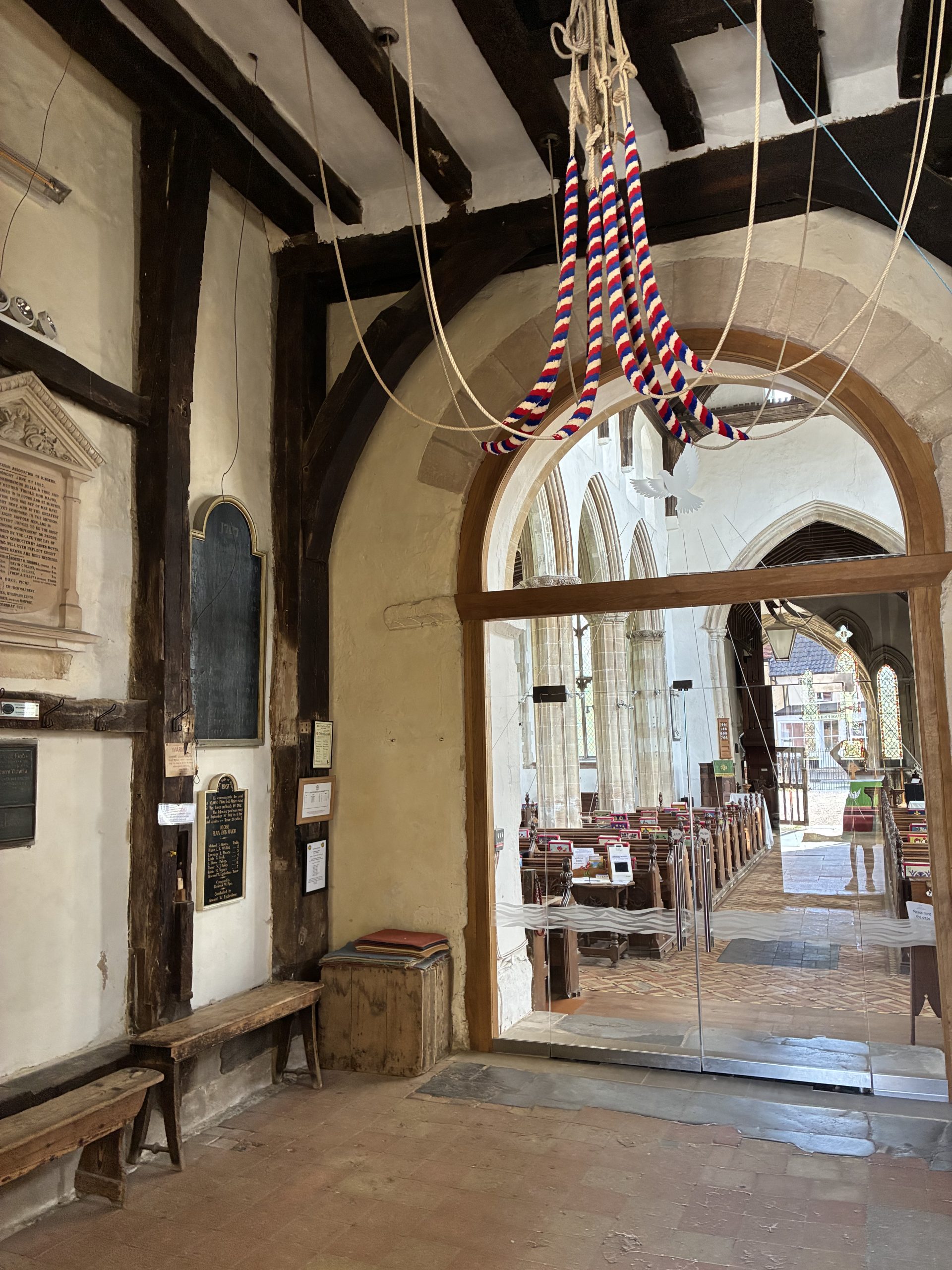
The church and its belfry.
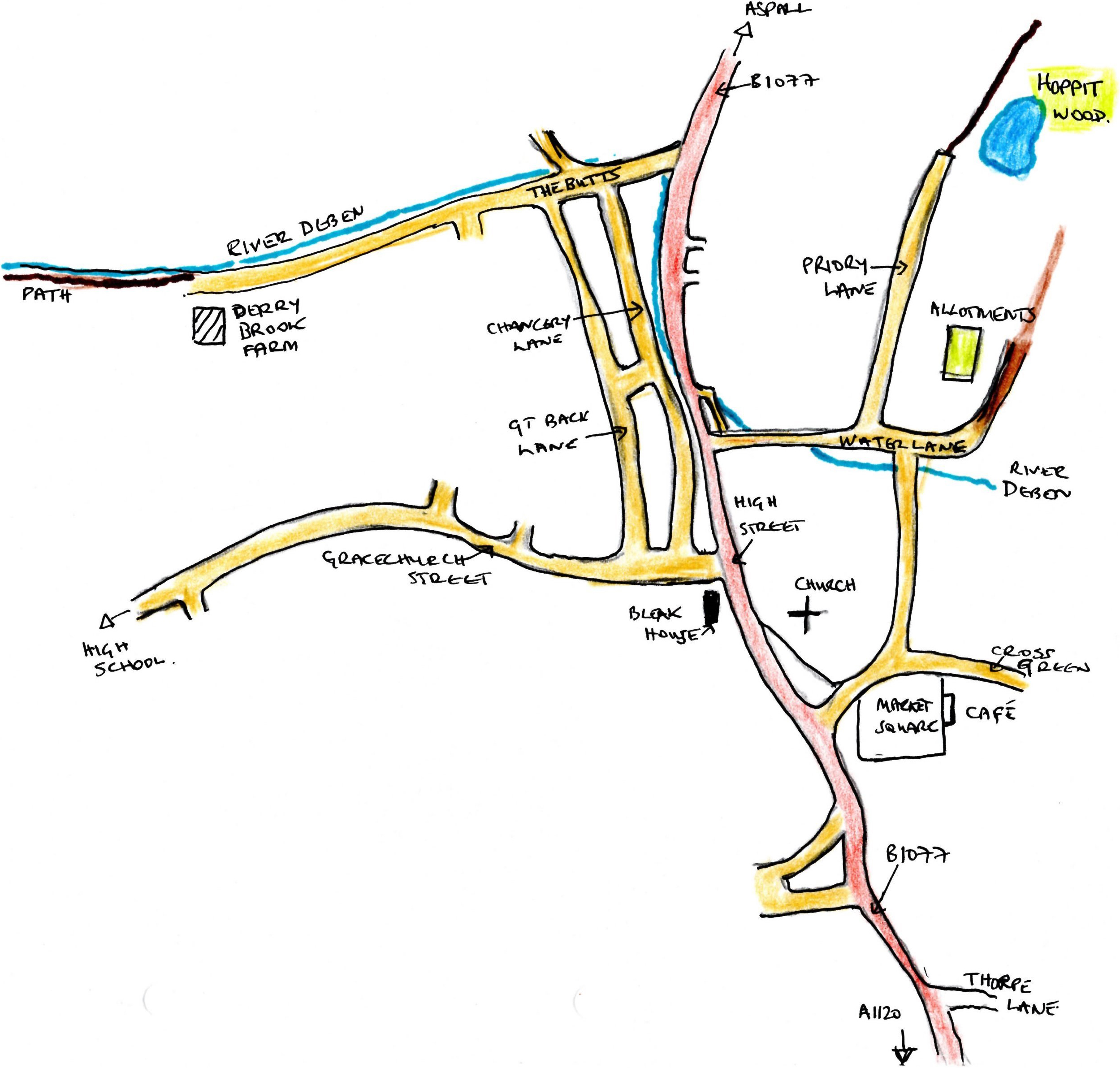
Debenham had both Roman and Anglo-Saxon settlements long before its record in the Domesday book. The village, a major centre of the wool and cloth trade in Tudor times, feels untouched by the intervening years; the same broad high street sweeps gently uphill, crowned by the church of St Mary Magdalene. In front, the old Market Place, with the excellent River Green Cafe, is surrounded by ancient cottages. A small path leads to the surprisingly large church. Entry, through the Galilee Porch, is under the somewhat squat tower, dated to the C11th, the walls of which hold plaques celebrating numerous peals. The light-filled body of church, built over the following four centuries, is well worth a visit.

Bleak House.
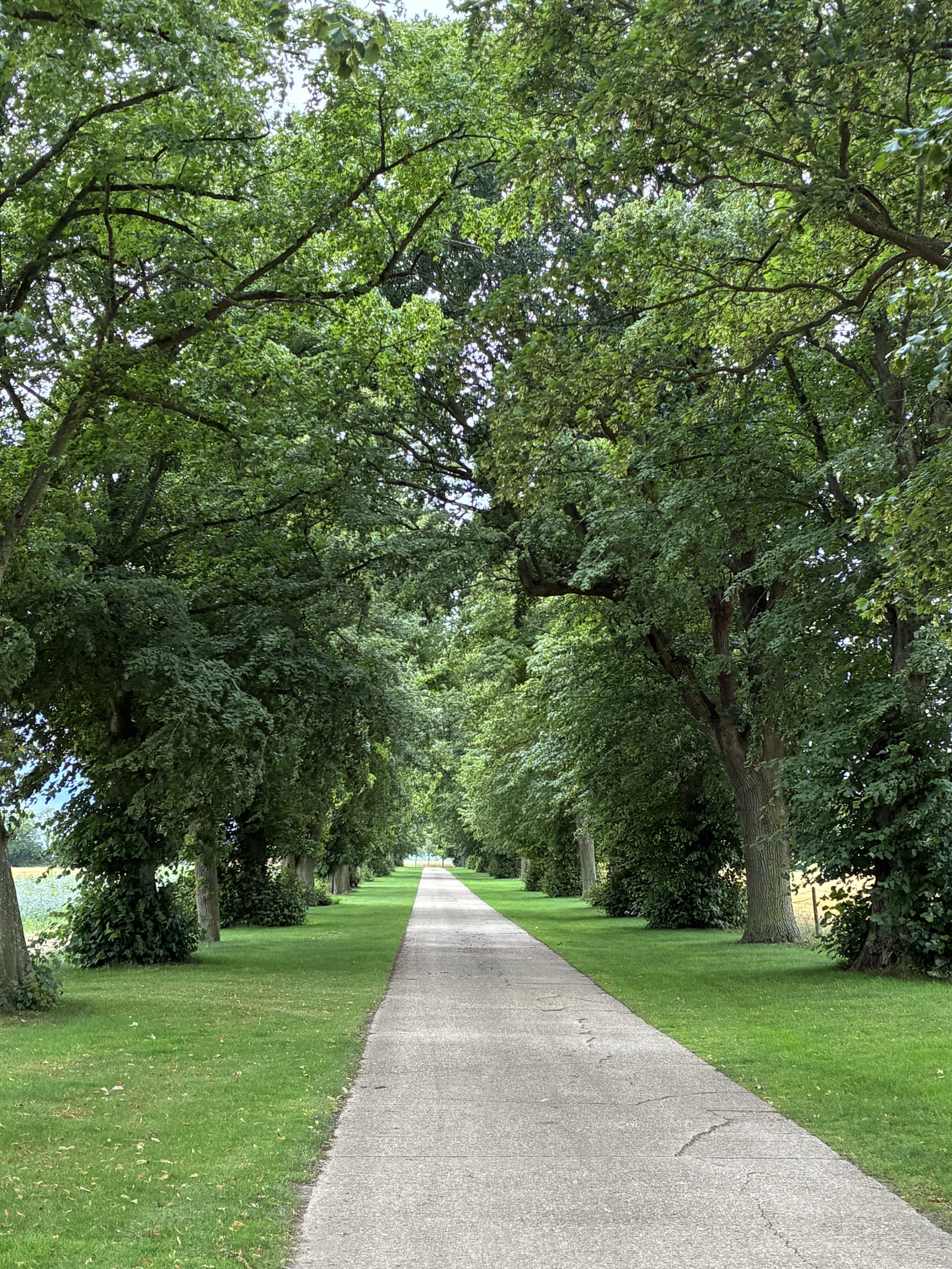
Beyond the church the wide street descends passing a variety of fascinating ancient buildings, notably the C16th ‘Bleak House’. There is an intriguing antiques shop, rumoured to have been used as a setting for ‘Lovejoy’, and beyond that on the right, Water Lane. Here the Deben can be seen to appear and disappear, using the road as a ford before dropping into a riverbed and on out of the village. Further down Water Lane, on the left, a path leads past productive village allotments, into Hoppit’s Wood, a beautiful tree planted nature reserve. There is a small lake filled with waterlilies surrounded by purple loosestrife; a delightful haven for local recreation filled with wildflowers and bird song.

Harvest fields on the way into Debenham.
On the opposite side of the high street, Chancery Lane, again awash with glorious cottages and gardens, leads down to The Butts. Take a left turn here and keep to the track beside the riverbed to reach Derry Brook Farm. Here a footpath follows the early—and very dry in August—path of the River Deben, it keeps to the bank of what in winter must on occasion be a torrent. At Brice’s Farm follow, ‘Stony Lane’, as the river course is known—reputedly the longest ford in England—this would certainly be worth visiting after significant rainfall. The walk beside this part of the river is detailed in the circular walk to the west of Debenham. It is a delightful mixture of high Suffolk farmland, blistering today in post-harvest haze, and a chiaroscuro of dappled light on the riverside track.

Blood Hall.
Back in the village, a second longer circular walk, to the east and north of Debenham, starts in the market square. The route ambles through wonderful high Suffolk agricultural landscape, passing the Tudor moated Crow’s Hall, on to another moated manor, Kenton Hall, dating back to c1200, and close by the wonderfully named Blood Hall, near the site of the Blood Field Battle of c870. This walk returns via the ancient walkway of Priory Lane into Debenham passing through the delightful Hoppit’s Wood.
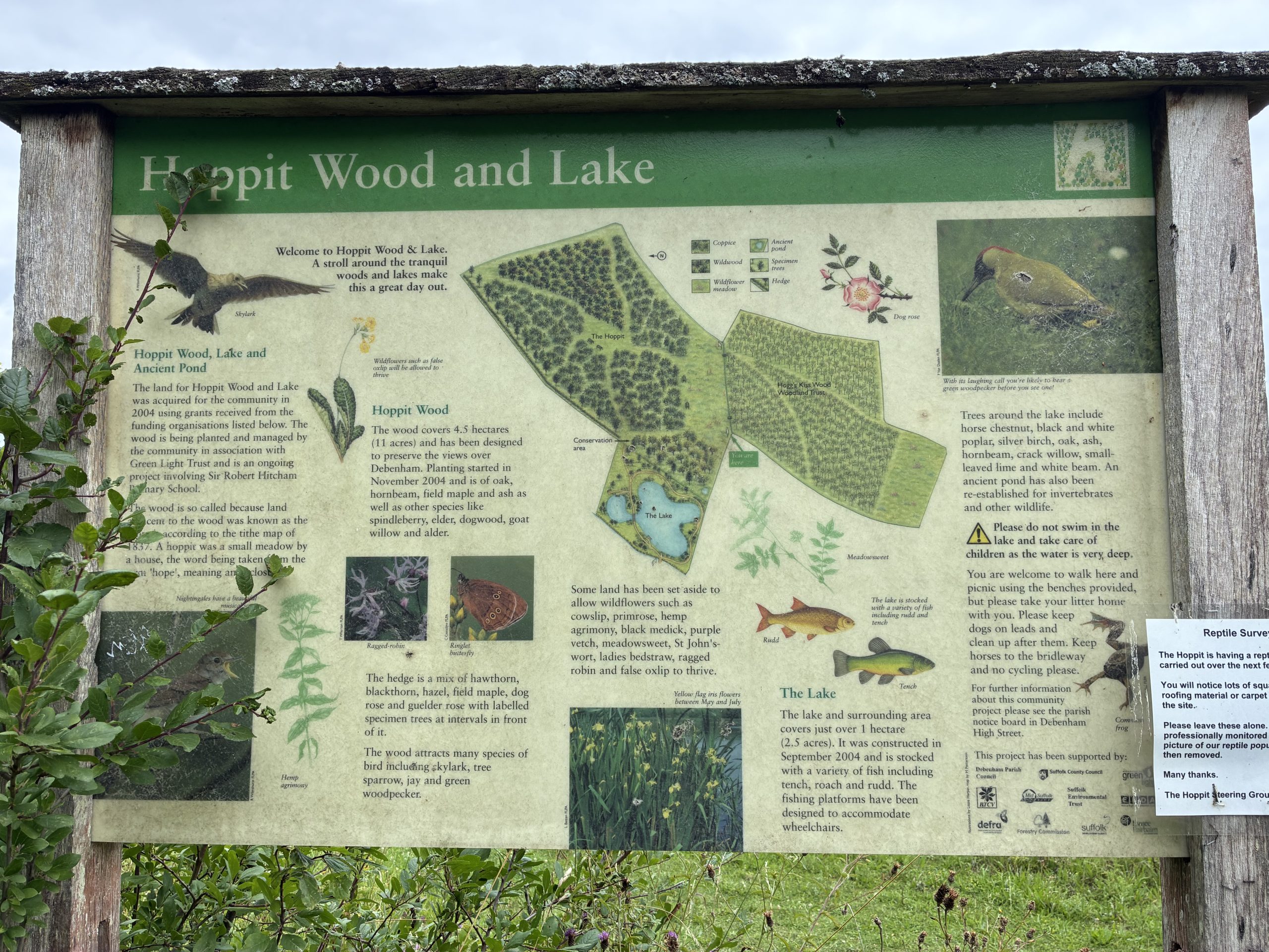
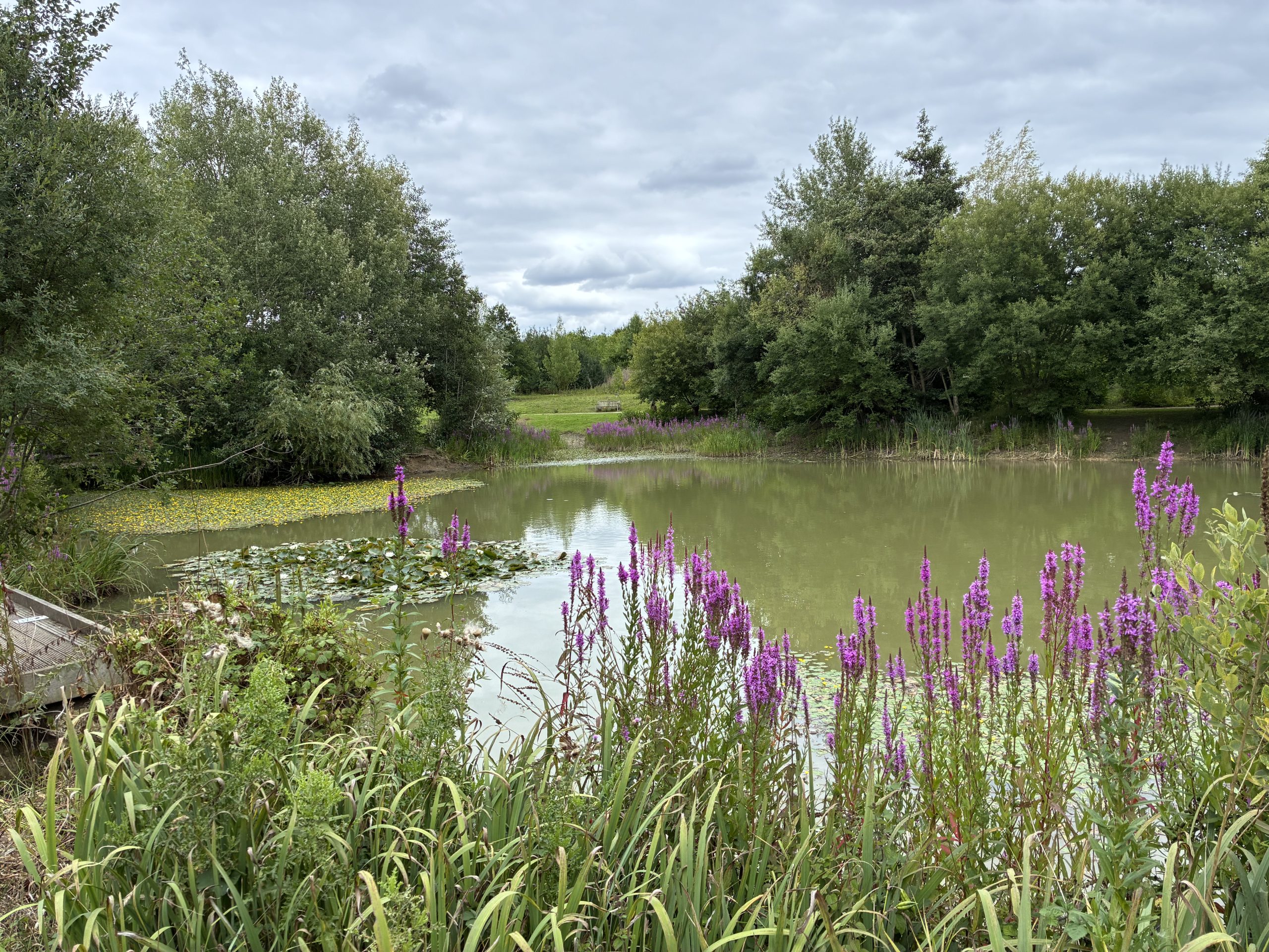
Hoppit’s Wood and Lake.
1. The Moated Manors of the Upper Deben Valley
OS Map Reference: TM174632 / TM 17494 63127
What Three Words: lushly.reflector.battling
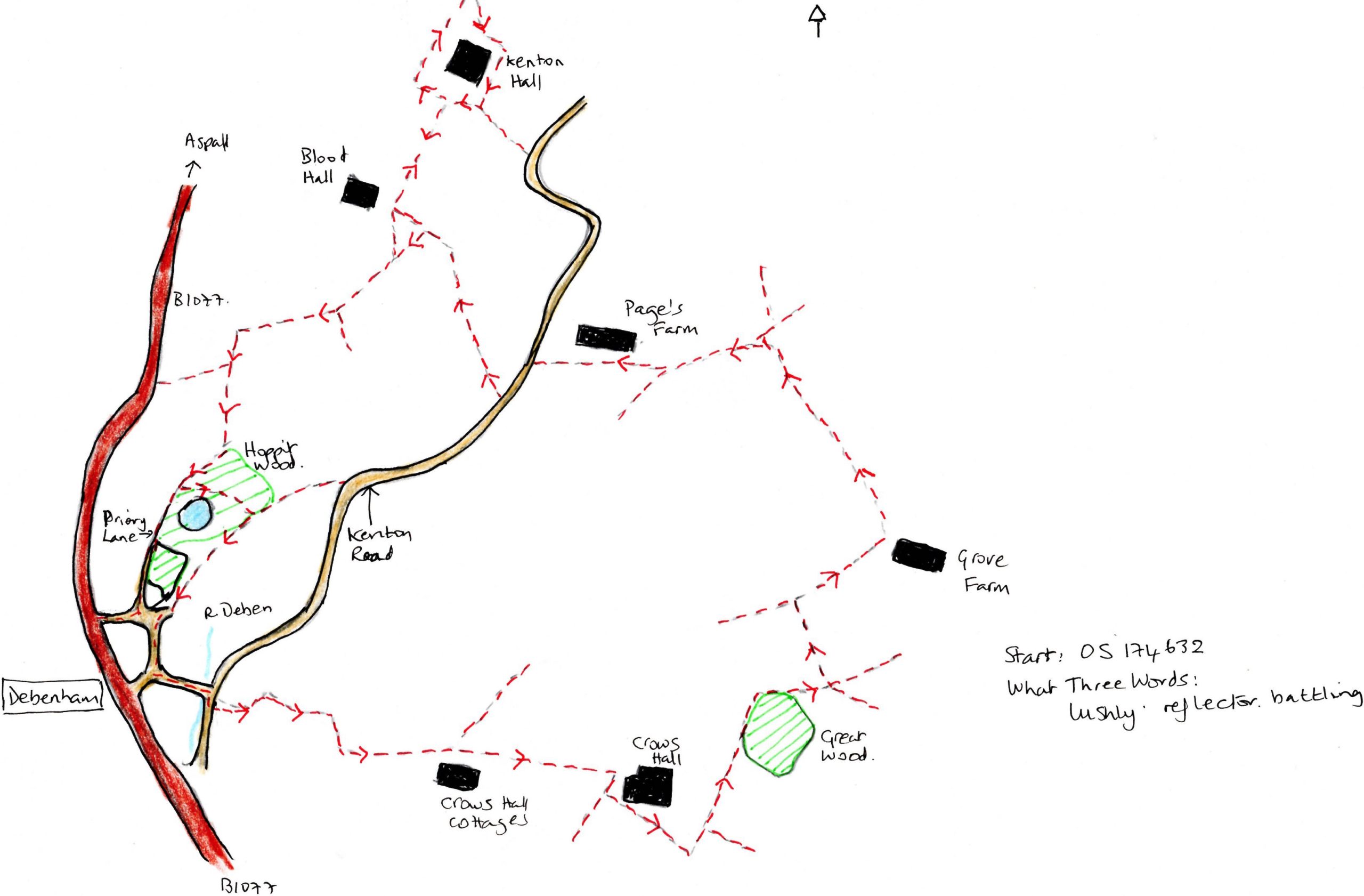
This 3-hour walk takes in the upper Deben Valley to the east and north of Debenham; a longish ramble through remarkable, unspoilt countryside. Fields of wheat, newly harvested, ancient houses, and interesting rural businesses are scattered throughout as are woods, moats and ponds. Above, buzzards mewed and as we walked the sun beat down. This is a walk where taking a map beside these notes is of benefit as there are some short cuts and extensions to the route described. Parts of the walk are clearly marked, others you might need to wing it! Take a flask and a picnic and enjoy.
Start at the Market Place carpark, or failing that, turn down Cross Green keeping right to find a place on the wider road. Once on foot, proceed down Cross Green, cross the bridge over the River Deben, turn right on the road, and then very shortly left onto a footpath. Follow this uphill and through a gate. the route is clearly signed round field boundaries until meeting Crows Hall Lane. Turn left here and keep ahead until a fork in bridleways (*left fork forms a short cut), otherwise, keep right towards Crows Hall.

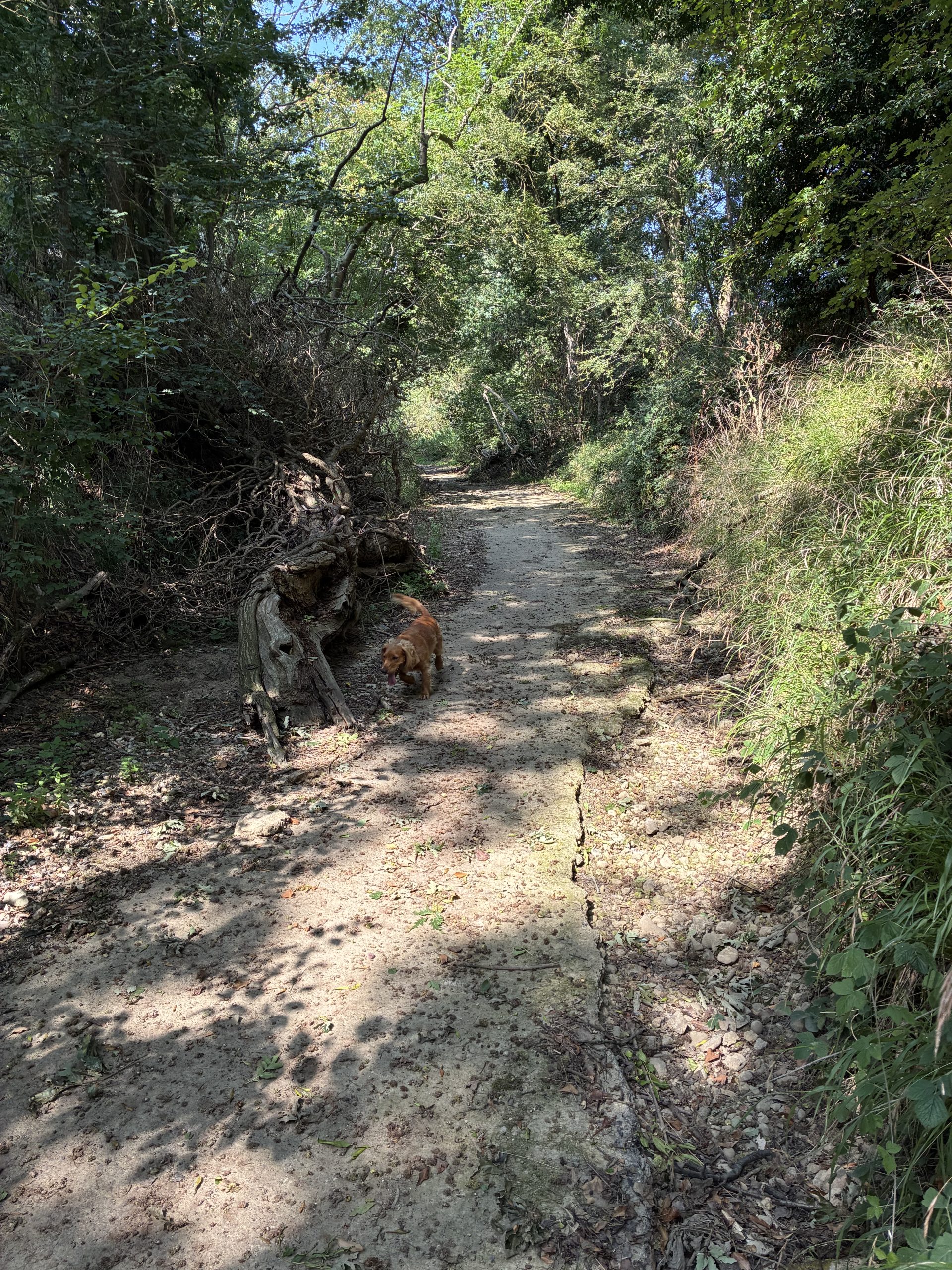
Footbridge over the dry bed of the Deben.
At the farmyard turn right where signed and on entering the yard, keep to the track on the right as signed and then left along a field boundary. Where the path turns sharp left keep the tall hedge on your left and follow the route alongside a wood, taking a right at the end of the wood over a bridge. In the middle of the field at the cross paths, turn left and keep ahead over two fields until meeting a bridleway. Turn right. (*If you take the short cut before Crows Hall this is where the two walks meet).
At Grove Farm turn left along a long bridleway, following an ancient walkway under trees. The bridleway curves left at a junction of paths, keep left and very shortly take a small track off to the right. Signed but not very clearly. This path should cross two fields at a diagonal, but the farmer here has not been kind and it’s necessary to follow field boundaries at Page’s Farm to make your way to Kenton Lane. Turn left on the lane, then right along a bridleway to Blood Hall. ** Shortly before the hall take a footpath on the left (unmarked at the time of walking) across a field, it goes towards a line of oaks, reaching a ‘T-junction’ of paths. Turn right, the paths are now marked again, and at the next fork keep left to cross fields and descend to steps down to the deeply incised footpath along Priory Lane, turning right this leads directly back into Debenham.
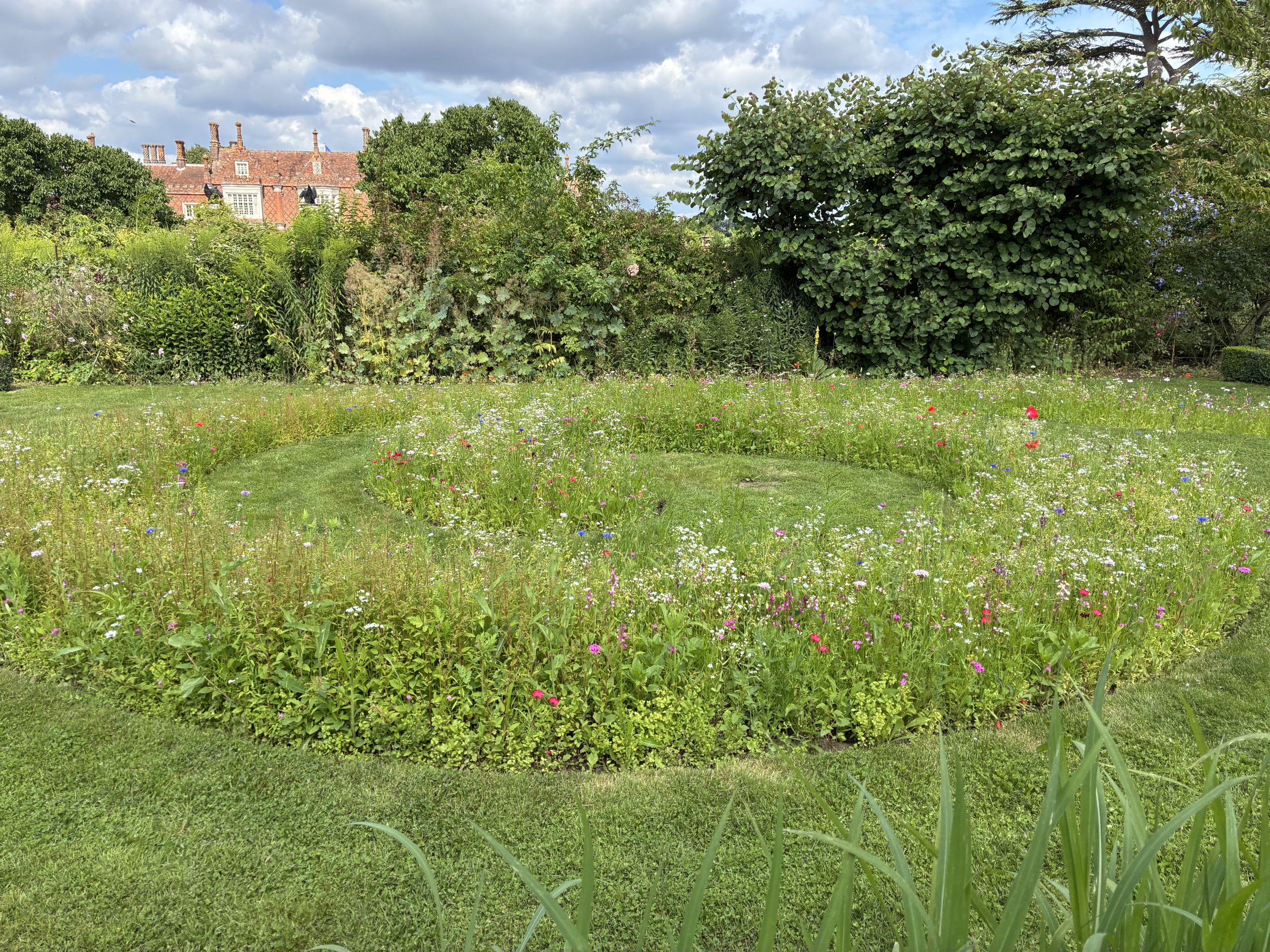
Kenton Hall.
Alternatively, there is a left turn at the junction with the Hoppit Wood and Lakes, take this to meander around this charming lake. On the further shore, keep left up the slight incline to meet a track and turn right towards the village. The track works its way alongside the village allotments to reach Water Lane. Then either bear left along Priory Road to the Square, or turn right up Water Lane, to reach the High Street.
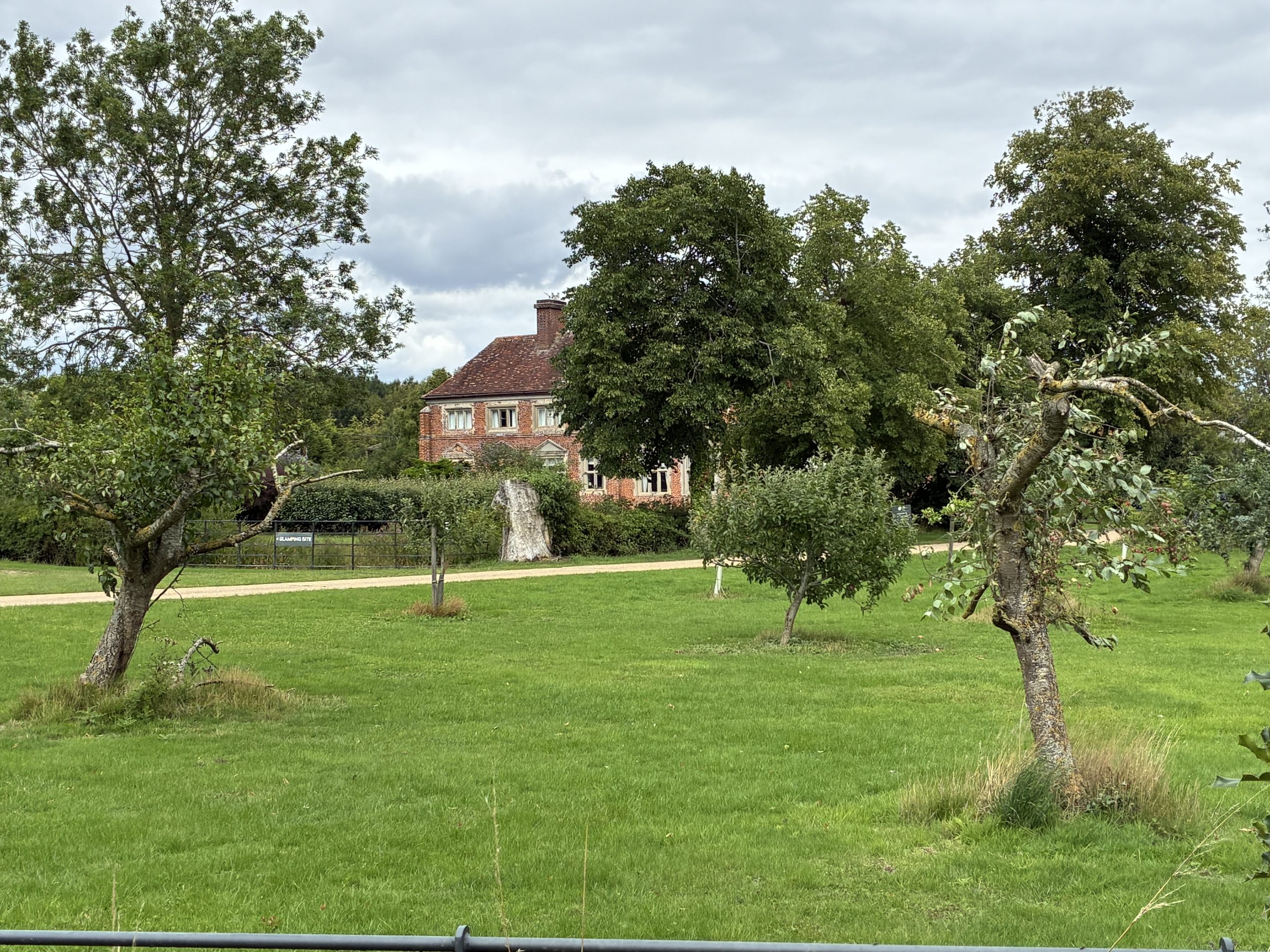
** An extra detour. Keep ahead on the track meet the drive of Blood Hall and Kenton Hall and turn right up the splendid avenue of Oaks to Kenton Hall. Passing Five Rod Farm market garden. Just before the Hall turn left along a path, and then right. The path works its way around Kenton Hall, with glimpses into the Tudor Manor and the rather splendid Glamping set up at the rear. Once the circuit is completed, return to where the path leaves the bridleway.
2. A walk to find the source of the River Deben
Map Reference: OS TM174634 / TM 17334 63409
What Three Words: ending.directive.orchids
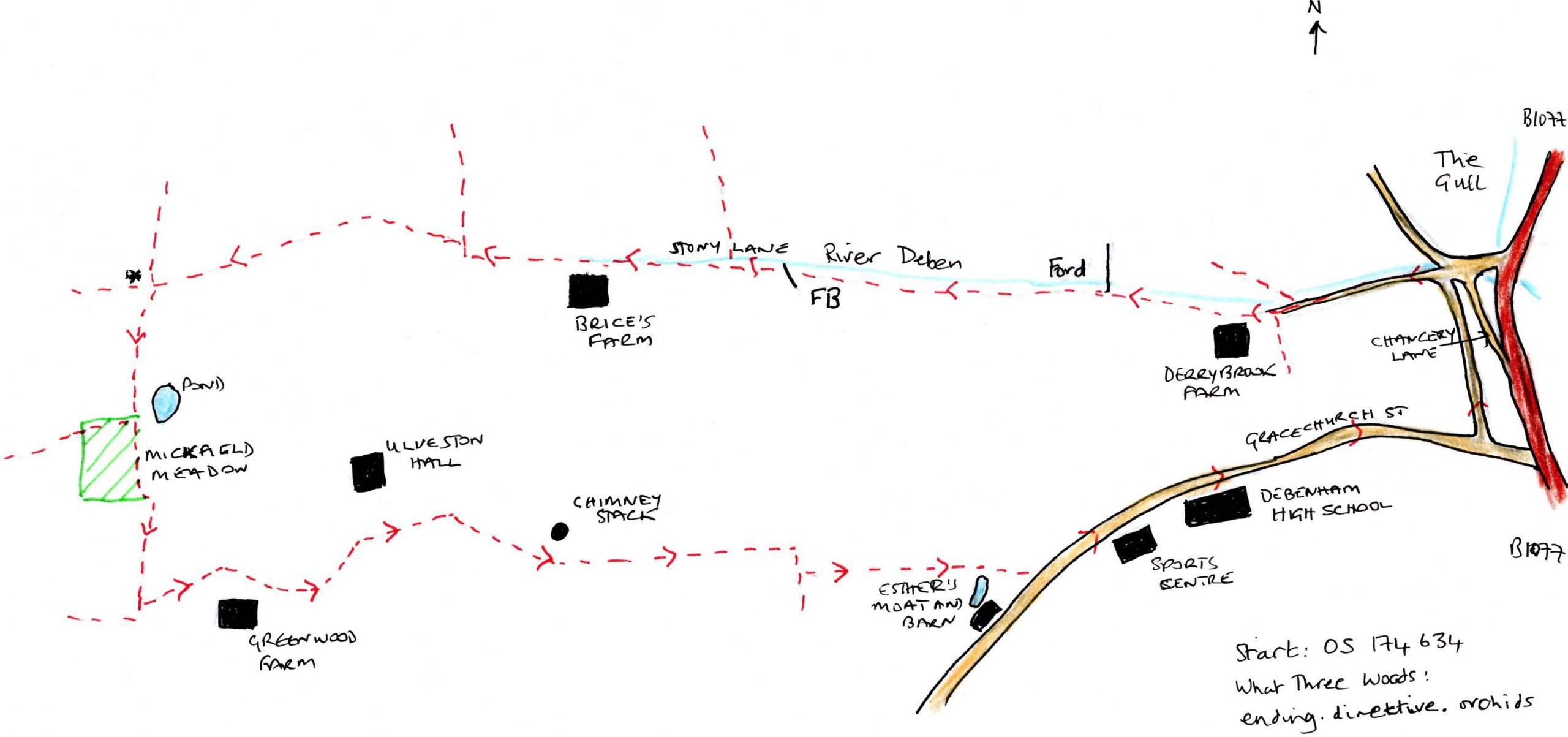
Walking to find the source of the river on a warm mid-August day was a delight, if a dry one. Park near Chancery Lane and take this unspoilt road past its old houses and cottages, to reach a crossroads. Turn left and you are on a small road that becomes a track beside it on the right, is what might seem to be a ditch, dry at the time of walking, this is the River Deben. Continue with this ‘water course’ on your right as the tarmac gives way to a track and after Derry Brook Farm, a delightful path, at times following close by the river, at others high above the banks with wide vistas over the harvested fields. Birds wheel above the stubble, light flickers along the half-track riverbed, known as Stony Lane—reputedly the longest ford in England. It is a clearly defined route.

Cottages on Chancery Lane.
Stony Lane.
After the stunningly situated Brice’s Farm the route becomes a permissive bridle way. There are a couple of small right and lefts but keep ahead on the permissive route. The path narrows following a small ‘ditch’, keep alert as it is important to turn left at a small unmarked cross path. It is no more than a break in the trees: what three words: marching.garlic.grownup. A marker some 20 metres beyond the left turn confirms your position. Follow this ahead to find a small, deep pond on your left before a bridge. Over the bridge you enter the Suffolk Wildlife Trust—Mickfield Meadow. It is from here, and the fields beyond that the source of the River Deben is to be found.

Watercourse worth a re-visit in winter perhaps.

Pond at Mickfield Meadow, Source of the Deben.

River Deben at start.
Keep ahead over Mickfield meadow and take the gate at the end on the left, making a slight right once through to follow the hedge. Before the next bridge take the gate on the left, not clearly signed, and walk diagonally across the meadow, behind the very beautiful Greenwood Farm, then on over a field to reach a small bridge. Now the signage becomes poor. Turn left after the bridge and at the next corner, take the route at a diagonal uphill towards barns. At the barns, bear right and then slightly left to cross a field, again very poorly signed to meet the farm track just to the right of the chimney stack of a ruined house. Keep ahead on the lane, go round the sharp right-hand corner and take the footpath on your left, passing Esther’s Moat. At Gracechurch Road turn left to make your way back into Debenham past the sports centre and high school.
Sue Ryder Richardson
Sue Ryder Richardson was born in Suffolk and has explored it on foot for as long as she can remember.