The Waldringfield History Walk

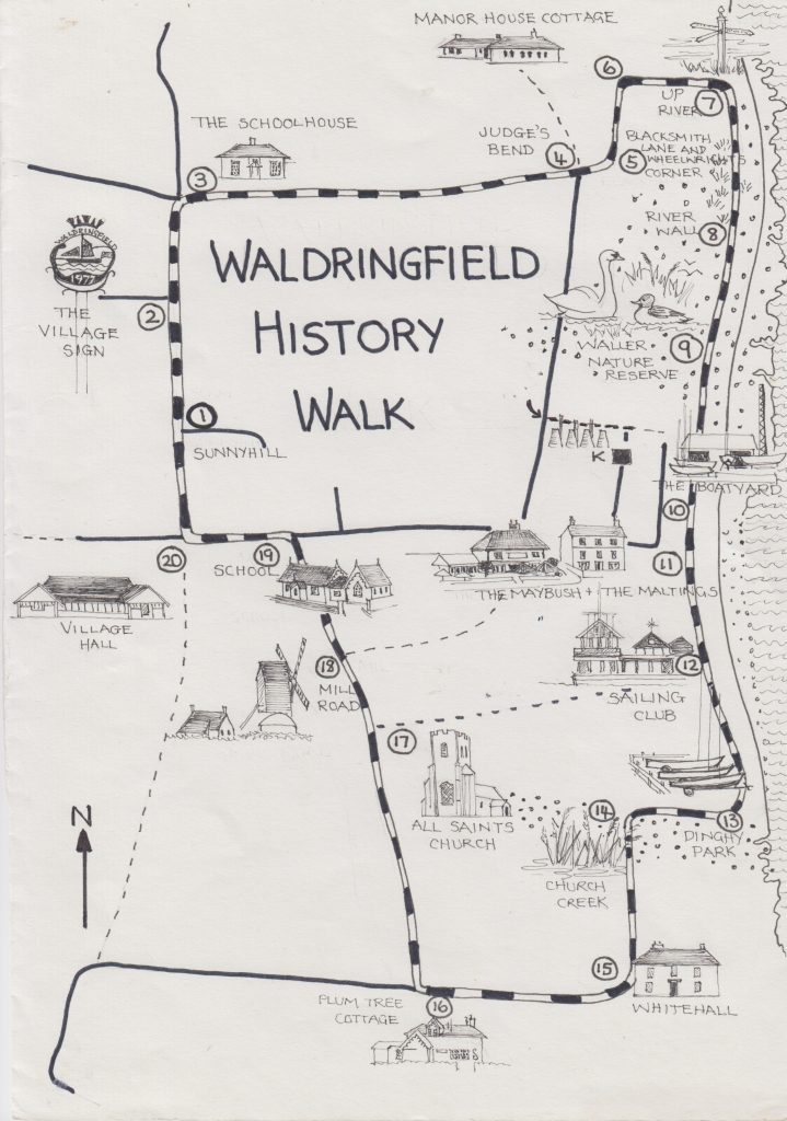
In 2025 Gareth Thomas, supported by other members of the Waldringfield History Group, devised a History Walk as part of the two-day community event Waldringfield Beach – memories of the timeline, held over the weekend August 30th-31st.

We are grateful to the WHG and Gareth Thomas for permission to reprint this (first published on their website) for others to enjoy.

Walk map by Jackie Brinsley

JB 2026

To download a pdf copy of the walk either scan the QR code below or click here.

➢ The walk starts at Waldringfield Village Hall where parking is free.
➢ The walk is just under 5 kilometres and is likely to take about 2½ hours.
➢ There are sections where the ‘going’ may be muddy.
➢ The walk is circular and returns the walker to the village hall car park.
➢ The ‘Maybush’ is situated about half-way round.
➢ There are twenty recommended stopping points as shown on the map

Continue reading

New Deben Walks

OS Explorer 197 Ipswich, Felixstowe & Harwich

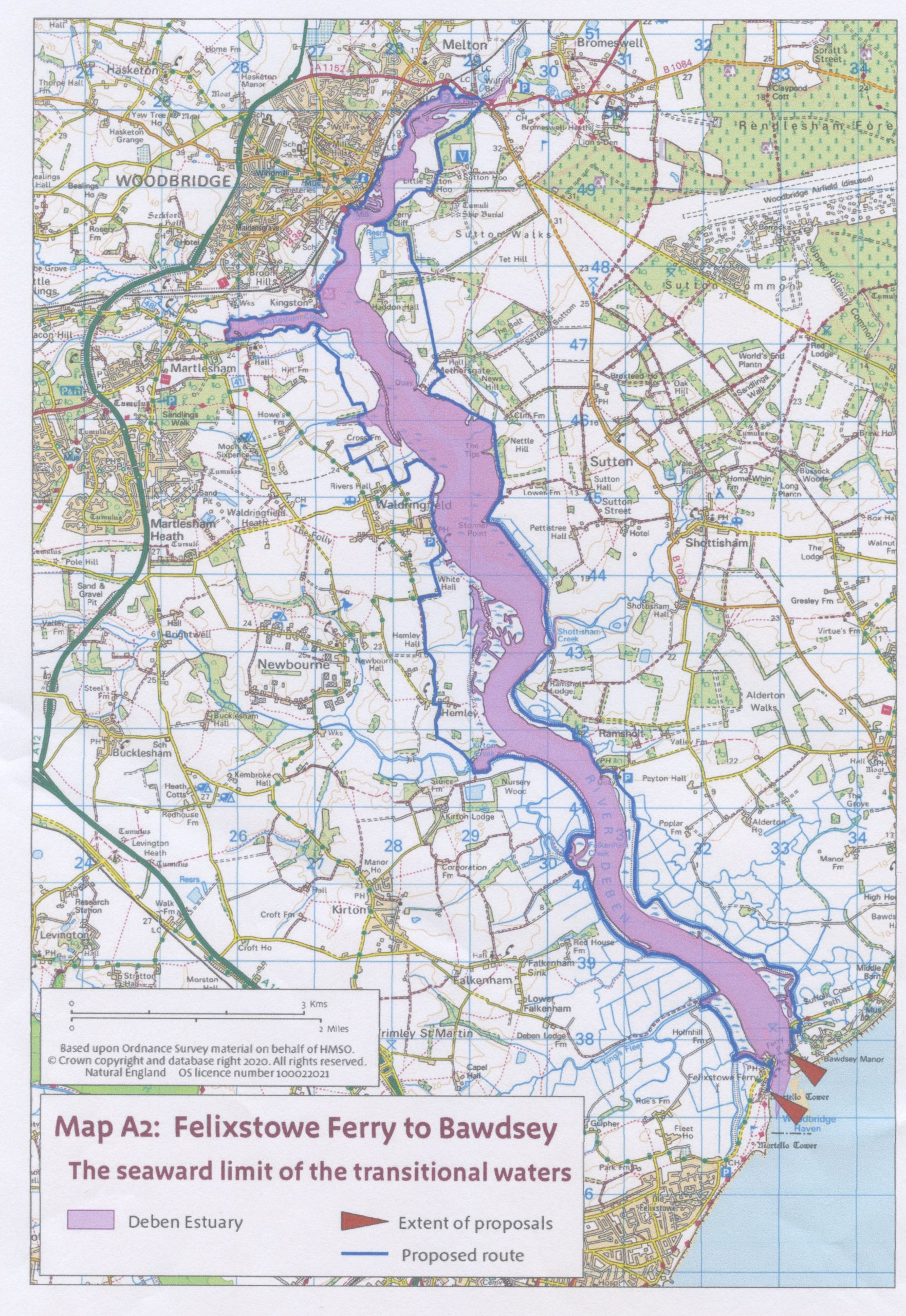
In September 2025 sections of the recently-created King Charles III England Coast Path were opened along both banks of the Deben: from Bawdsey to Wilford Bridge and Wilford Bridge to Felixstowe Ferry. See map with the whole route marked in blue. Much of the Coast Path route is along existing rights of way. However, there are three ‘new’ sections which Judy and I decided to investigate this autumn.

Continue reading

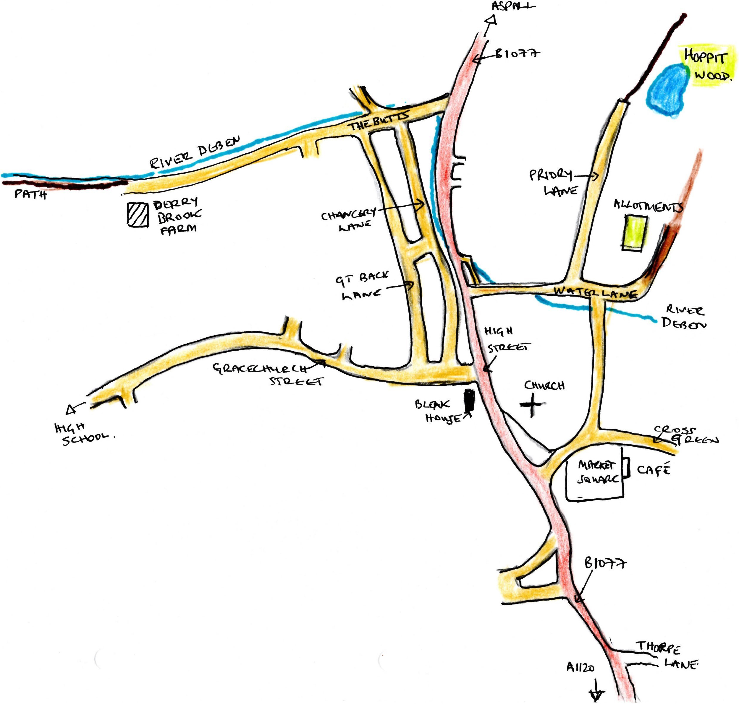
Two Debenham Walks

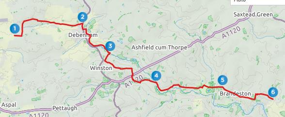
Introduction

Some thirty-four miles inland from the mouth of the Deben, the village of Debenham nestles in quintessential Suffolk landscape. It is one of the unspoilt medieval gems of high Suffolk. To the west of the village, around Mickfield meadow, lies the source of the Deben, a sometime trickle of water in a field of flowers.

Continue reading

A Two-Felixstowe-Church Walk

Janet Harber and her sister Jackie Jones are the first to take up the challenge of linking two of more of the Deben churches described by Gareth Thomas in his four-part series last year. Their Felixstowe-based walk was published in The Deben magazine #70 and is reprinted here with additional photographs taken by Janet.

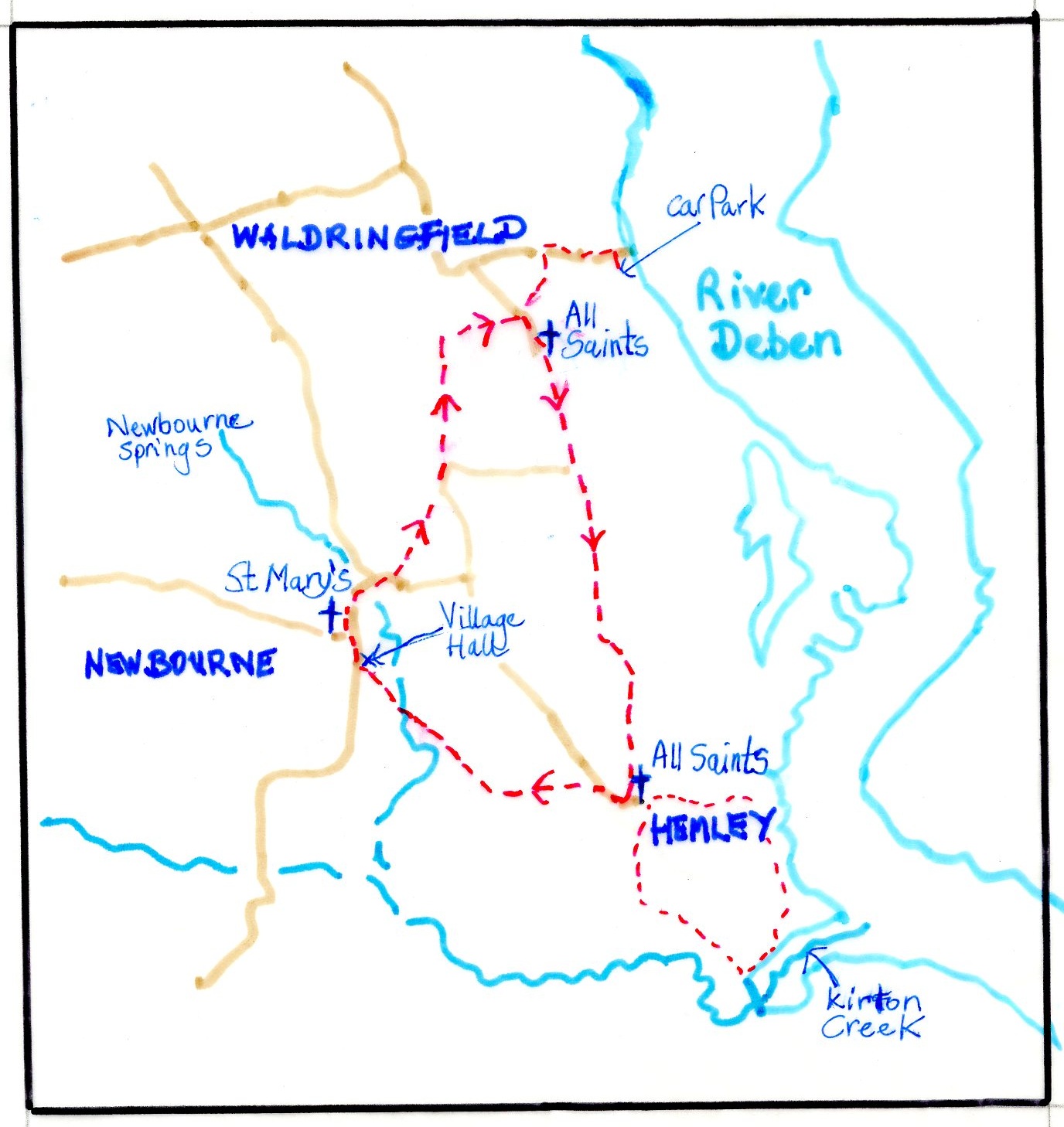
If you feel inspired to try to devise your own walks, linking different Deben Churches, you will find a list at the end of this article. Alternatively you might enjoy Sue Ryder Richardson’s circular walk from Hemley Church.

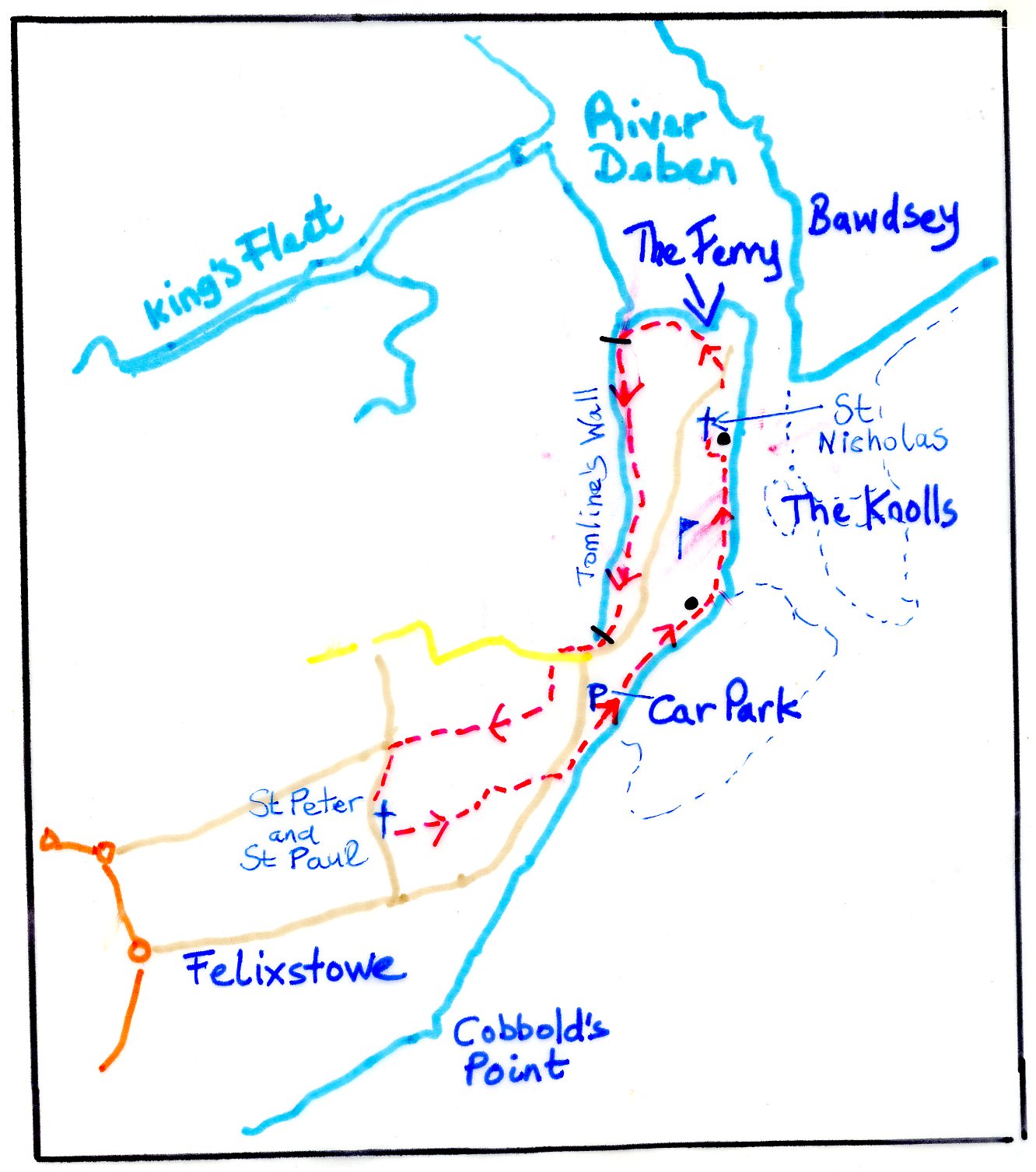
This five-mile route, a mix of coastal and surburban walking, links the churches of St Peter and St Paul in Old Felixstowe and St Nicholas at Felixstowe Ferry. The two churches are described in detail by Gareth Thomas in his RDA Journal series Churches of the Deben: Part 3B.

Continue reading

Confessions of a Serial Litter-Picker: The RDA Autumn Talk, Nov 5th 2024

I’ll be honest – I had no idea that a talk about litter was going to be so interesting and emotive. Not only the emotions of disgust, incredulity and anger — which thinking about litter evokes all too easily – but engagement, humour, surprise, compassion, admiration. Yet that’s how I felt listening to Jason Alexander’s presentation to the RDA on Bonfire Night. A good moment to be sweeping up some old preconceptions and seeing them burn away cold night air, giving out warmth and inspiration as they go.

This is the story of a one-man campaign and a movement we can all join, on our own or working with others.

Continue reading

A Walk from Shottisham to Ramsholt (and Back)

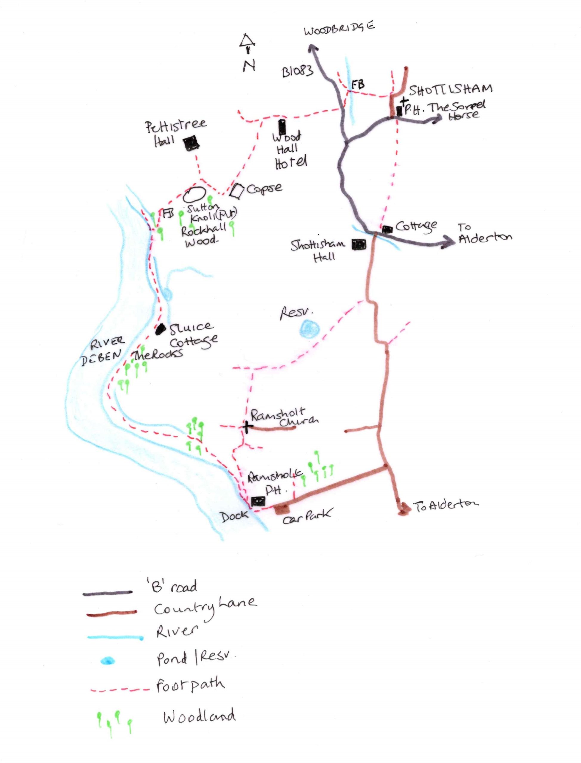
Like the River Deben itself, this walk is one of two parts: from dry pastoral uplands to the salty, tidal marshes and mudflats. Start in the tiny village of Shottisham, a place where time has stood still; a cluster of cottages nestle around the picturesque Sorrel Horse pub, a path leads up to St Margaret’s church, and a playground. There is a white weatherboarded watermill set Constable-like amongst trees, and all this is surrounded by cornfields and pastures. The village captures the essence of Ronald Blythe, as it settles in a landscape that recalls the horse-drawn plough of George Ewart Evans.

Continue reading

Martlesham Walk

By Sue Ryder Richardson

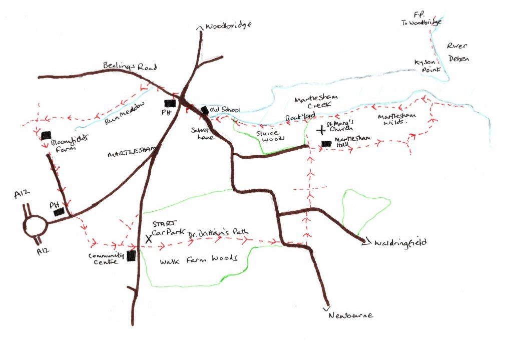
Map. OS Explorer 197. Map reference: 250462

What3Words: ///widget.depending.sourcing

Distance: 5.25 miles

Refreshments: The Red Lion and Black Tiles, Martlesham

Click to Download Map

Whatever the season this walk is beautiful. On a cold winter’s day when there is a crispness to the air, the marsh can prickle with frost and the river, with its mud ridges and shallows, has a sharp clarity. The air echoes with the cries of birds, and waders impervious to the temperature, strut and pick at the banks. This time we walked in late summer and Walk Farm Woods at the outset offered welcome shade as we wandered through its chiaroscuro of light. Too early for mushrooms, or the turning of deciduous leaf, but both poised to promise autumnal glory in the weeks to come.

Over the Saltings

Continue reading

A walk through the landscape of the Upper Deben Valley – Brandeston, Monewden and Cretingham

By Sue Ryder-Richardson

Download Walk

Map: OS Explorer 212 TM 251604. Start: Bridleway on Kettleburgh Road at east end of Brandeston village. Distance approx 6.5 miles.

The Upper Deben Valley in August 2022 is biscuit dry. The small rills, the source of this beautiful river above Debenham, are dried, fords and water splashes empty, yet further downstream in the heart of the farming countryside of Brandeston*, Cretingham, Monewden, as if by magic, the Deben has gathered some water, and flows gently through its green, tree lined valley.

Continue reading